Official Camping Trip Report Thread

This site may earn a commission from merchant affiliate
links, including eBay, Amazon, Skimlinks, and others.

After I started heading west, I went to the Wolfpen Campsite. From there I was able to take some open backroads....in and out back deep into the Black Warrior WMA...to the south of Sipsey. Here you can camp....first come, first serve with no limit to numbers of people. In Sipsey, it is limited to 8 per group and camping is all backpack type stuff.

If you are interested in seeing where these places are, there is a great map called the Sipsey One Page

http://www.briartech.com/sipseyonepagea.pdf

My first main hike was to Eagle Falls, this was the longest hike I went on. I was gone about 90 minutes including the time I spent at the falls. It is an amazing hike. Super remote with a great camping area above the falls.

image-X3.jpg


image-X3.jpg


image-1597x1252.jpg
 
I ran into some cool cats on the way back out that were part of an internet forum for hammocks....hammockforum.net......how awesome is that?

image-X3.jpg


One of the guys told me not to miss Turkey Trot Falls just down the road. None of this stuff is marked from the road which is amazing. Waterfalls like these would have a 50 car parking lot by them in North Carolina and hundreds of assholes. At waterfall 3 I was the only a****** to be seen.

image-X3.jpg


This waterfall was 1/4 mile off the road.....maybe. No parking place. Just pull off the road, hunt for the path and boom.

image-X3.jpg


image-X3.jpg


I cannot wait to take the family back here with some Eno's and some books and just chill out all day.
 
Outstanding Recon. So much so wife is interested.....
 
Thanks Shush....I appreciate the kudos. I mainly put this stuff here to refer people to it, no one else really gives a s*** LOL

The main river crossing on the south side of Sipsey is the area most people have seen. It is a US Fee area. ($3) and you can wander around some nice flat trails and jump in the river. I drove in and drove out just to pose on the cool bridge.

image-X3.jpg


image-X3.jpg


When I say no one was there......no one was there. Granted this was a Friday, but damn. Perfect weather.....less than 2 hours from Birmingham and no one. It was if I rented the place. So much so I was able to just leave my pile in the middle of the bridge running and take poser pics from afar....

image-1597x1252.jpg


I even climbed up on the roof and took a poser pic and some GoGro footage.

image-1597x1252.jpg
 
So at this point I start into the meat of the Wilderness area. I first take a road back to the east to Borden Bridge. Unfortunately, the parking area is about 1/2 mile from the bridge so this was a dead end. I think this road would be pretty nice if the leaves were off......

This road was the winner though....it would way way up the mountain back into the center of the park. I am sure lots use it to support hikers back in the backcountry. It is not properly marked on the One Page, but if you ever get there, use the park map and take FM208 east when you get the option. FS208E picks back up on the maps at the top of the mountain and the road (FS229) leads you to the north end of the Wilderness Area (I have GoPro video but no pics)

image-1597x1252.jpg


FS229 dumps into FS223 that I took back to the south to Gum Pond Cemetery. What a remote place to be buried.....I can't imagine how tough the people were that lived here in the early 1800s.

image-X3.jpg


image-1597x1252.jpg
 
I backtracked out Divide Road to the east....I left the wilderness area in places and saw some houses and camps. When the road turned back south into the wilderness area I decided it was early enough to dive back into the woods. This road is depicted as Wilderness Springs Rd on the One Page. It dumped me back on Highway 33 which is the east border of Sipsey Wilderness.

The ranger at Double Springs had told me about a lake and a horse camp on the east side of Bankhead National Forest to check out so I again, turned further away from camp and explored some more.

image-1597x1252.jpg


image-X3.jpg


image-X3.jpg


Nothing on this side of the national forest really floated my boat except the dogwoods. There were thousands of them on this side of the mountain. Really a pretty time to see them all in full bloom. If you like horses, this is your spot too. Me, I was ready to call it a day so I turned back northwest for home.

I wanted to hit Rattlesnake Saloon before I headed back to Hawk Pride so I took off out of the National Forest. I had driven about 75 miles in the Wilderness area and surrounding National Forest and about 50 of them were off pavement.

My thoughts on Sipsey as a driving destination......this place is probably spectacular when the leaves change and when they are completely off the trees. There are very few areas where you can see into the distance and appreciate the scale of the mountains you were on because the leaves were so thick.

As a waterfall and hiking place? Wow. The short hikes I took were fantastic. The 3 falls I went to were all really peaceful and easy to access but you can tell they get few visitors.

This old barn was overlooking Cedar Creek Reservoir on the way to Rattlesnake Saloon

image-X3.jpg


image-X3.jpg
 
Finally, I eased into the Rattlesnake Saloon for a beer and a burger. This is a campground, horse place that has a beer bar, band and restaurant in a cave in the mountain.

I took the shuttle down into it....but I would have walked had I known it was only 100 yards......

image-X3.jpg


image-X3.jpg


The place was cool and I survived my undercooked burger with only mild indigestion. The band was pretty good. I think he was going to play a Haggard tribute for the whole night...he talked too much but I was solo so I decided to finish up by beer and head to the park.

I was gone about 10 hours and I drove about 150 miles round trip from Hawk Pride. I set up shop in the same spot as the night before and we listened to the band from a warm campfire till nearly midnight.

It's a great trip from Mississippi. If you want to go, let me know, I will get you more specifics on my routing.
 
Last edited:
Thanks Shush....I appreciate the kudos. I mainly put this stuff here to refer people to it, no one else really gives a s*** LOL

The main river crossing on the south side of Sipsey is the area most people have seen. It is a US Fee area. ($3) and you can wander around some nice flat trails and jump in the river. I drove in and drove out just to pose on the cool bridge.

image-X3.jpg

Notice the woody debris on the bridge. Heavy, heavy rains rolled through Alabama around Christmas and the water level in Sipsey Fork shot up to over 40 ft, covered the bridge and left those sticks.

This rec area is the put in to do a 10 mile float on Sipsey with the take out at AL 33.
 
Just got back from a couple of days in the Talledega NF and Cheaha State Park ( highest point in AL). Great stop on the way to Atlanta. Weather was great, cool enough at night that I got in the sleeping bag. We spent Thursday driving about 5 hours of forest roads through Talledega and never saw another human. Beautiful country. Some cool hidden lakes, waterfalls, etc. Found a great little cemetery in the middle of the NF full of handmade stone markers from the 1800's.
image.webp
image.webp
image.webp
image.webp
image.webp
 
Took this chick, who is growing up way to fast, for a dad & daughter day to the North MS Hill Country Picnic. I've been shooting portraits of the musicians at this festival for a couple years for a project that will hopefully turn into a little book. This year was purely as a spectator. It's a great time. Hot as s***, but if you wanna really experience Mississippi, with no made up bull****, this is it. 100% real deal.
IMG_5299.webp
 
Just got back from a couple of days in the Talledega NF and Cheaha State Park ( highest point in AL). Great stop on the way to Atlanta. Weather was great, cool enough at night that I got in the sleeping bag. We spent Thursday driving about 5 hours of forest roads through Talledega and never saw another human. Beautiful country. Some cool hidden lakes, waterfalls, etc. Found a great little cemetery in the middle of the NF full of handmade stone markers from the 1800's. View attachment 1284141
Once upon a younger age, I did some great top-roping on that lookout at Cheaha.
 
It's time for amatuer hour here in the camping report thread. Last weekend me and two friends went camping down at the Natchez State Park and did some exploring around the Windsor Ruins, Rodney, and Prospect Hill.

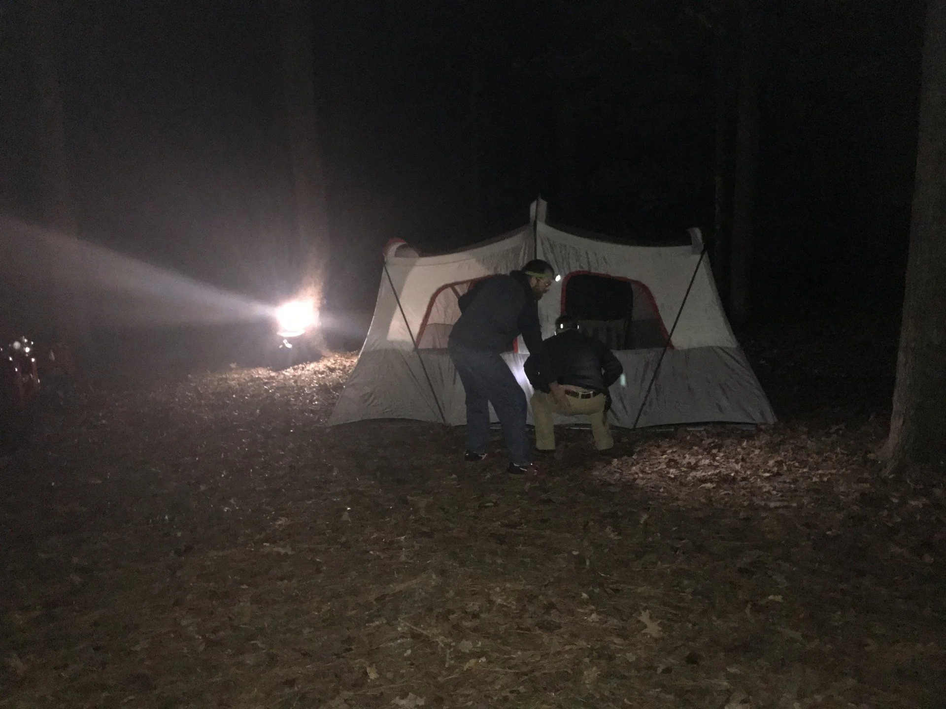
Friday while waiting for our 3rd to get done with work, we stopped at Lou's for some burgers for a late lunch before heading to Kroger to food/ice etc. Ended up leaving around 4:15 or so from Jackson. We went 55 on the way down through Fayette to 61 to try and make the best time. Obviously we were pitching the tent in the dark and trying to get dinner cooked (with a burn ban) and ready to head in for the night before the rain came.


Rain came and we retreated inside and switched to bourbon.
Did some damage.
 

Users who are viewing this thread

Back
Top Bottom