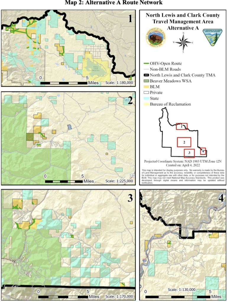
Located in Northwest Montana, the North Lewis and Clark Travel Management Plan is being prepared by the BLM which covers about 15,000 acres and approximately 23 miles of routes. Large portions of Wilderness such as the Scapegoat Wilderness and Bob Marshall Wilderness already sit adjacent to this planning area as you can see in the map below.

If more roads are decommissioned, creating areas where roads don’t exist anymore then Wilderness focused groups can continue advocating for 30X30 to create even more Wilderness in these Western States that are already heavily regulated by extreme travel management restrictions.
Noise disturbance, user conflict and safety along routes are being cited as main reasons for changes to routes.
E-bikes would only be allowed on motorized routes.
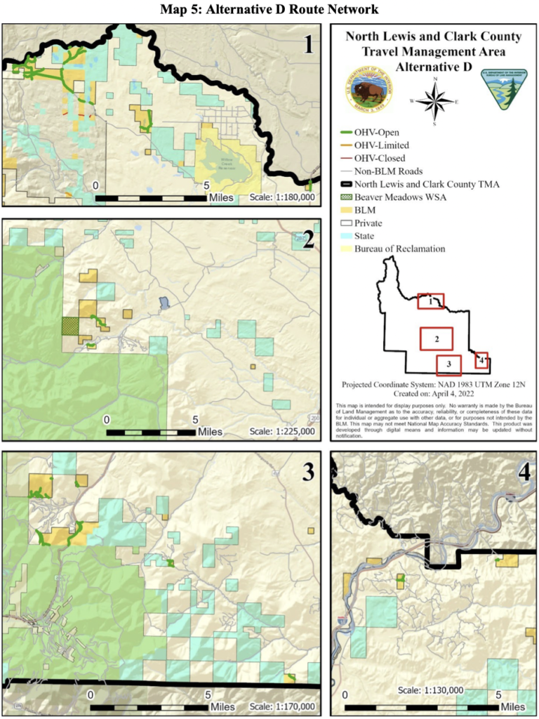
Alternative B is completely unacceptable as it would only allow 6.6 miles of routes to be open to OHV use. Alternative D would allow the most mileage of routes open to OHV use in comparison to current use (Alternative A). If you are familiar with specific routes in this area, please let the BLM know why they should remain open. Also if there are any discrepancies in the current use maps (Alternative A) please let us and the BLM know. Initial trail inventory was done by the BLM, however we want to ensure the BLM is starting with accurate baseline information.


Add your voice to ours and submit a comment to the BLM by October 9, 2022. You can read the entire project proposal through the BLM website.
Continue reading...
If more roads are decommissioned, creating areas where roads don’t exist anymore then Wilderness focused groups can continue advocating for 30X30 to create even more Wilderness in these Western States that are already heavily regulated by extreme travel management restrictions.
Noise disturbance, user conflict and safety along routes are being cited as main reasons for changes to routes.
E-bikes would only be allowed on motorized routes.
Alternative B is completely unacceptable as it would only allow 6.6 miles of routes to be open to OHV use. Alternative D would allow the most mileage of routes open to OHV use in comparison to current use (Alternative A). If you are familiar with specific routes in this area, please let the BLM know why they should remain open. Also if there are any discrepancies in the current use maps (Alternative A) please let us and the BLM know. Initial trail inventory was done by the BLM, however we want to ensure the BLM is starting with accurate baseline information.
Add your voice to ours and submit a comment to the BLM by October 9, 2022. You can read the entire project proposal through the BLM website.
Continue reading...