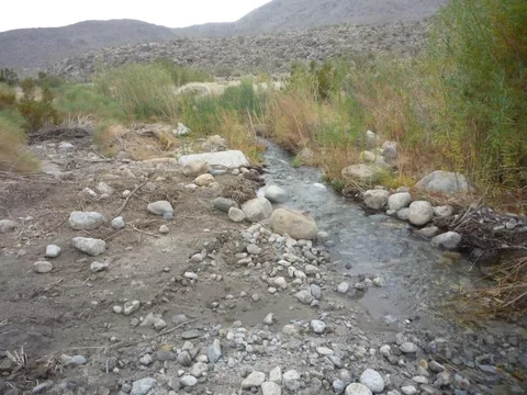
Coyote's 3rd water crossing
Well, it's true. Park officials no longer wanted the risk of the deep water crossing, so they changed things. I don’t know of another water feature like it in SD County, so quite a loss. I wonder if an accidental drowning occurred there. My guess is state lawyers played into the decision.

From the pics, you can see the boulders put in front of the entrance. Seems they also added to the boulder field in front of these too. Traffic is diverted, via a new sign, just to the right about 150 feet.

My 4 yr old, Brandon, is standing in front of the new water crossing. This is actually the second pond that you would drive thru just after you come out of the willow grove. The creek flows from right to left thru this pond. It use to flow into the willow grove, which sits in a local depression and made for the deep water. You may recall water flow that also came out near the entrance and ran down the trail. That is all dried up too due to dewatering of the willows.

The next pic shows the channel that now diverts water to the west of the willows. My guess is that in heavy flows, the willows will get some water. But I’m guessing that the willows will also shrink big time next summer. I’ll post more pics that show the exit out of the willows.


Well, it's true. Park officials no longer wanted the risk of the deep water crossing, so they changed things. I don’t know of another water feature like it in SD County, so quite a loss. I wonder if an accidental drowning occurred there. My guess is state lawyers played into the decision.

From the pics, you can see the boulders put in front of the entrance. Seems they also added to the boulder field in front of these too. Traffic is diverted, via a new sign, just to the right about 150 feet.

My 4 yr old, Brandon, is standing in front of the new water crossing. This is actually the second pond that you would drive thru just after you come out of the willow grove. The creek flows from right to left thru this pond. It use to flow into the willow grove, which sits in a local depression and made for the deep water. You may recall water flow that also came out near the entrance and ran down the trail. That is all dried up too due to dewatering of the willows.

The next pic shows the channel that now diverts water to the west of the willows. My guess is that in heavy flows, the willows will get some water. But I’m guessing that the willows will also shrink big time next summer. I’ll post more pics that show the exit out of the willows.
Last edited:


