Saturday journey

This site may earn a commission from merchant affiliate
links, including eBay, Amazon, Skimlinks, and others.

Joined
Jun 10, 2009
Threads
9
Messages
67
Location
West SAC, CA
Looking to get out of town tomorrow and have a little fun. Any suggestions of some mild trails off 80, 50, 20 or 49 that can be traveled through. Like going from Washington to Downeyville. Something that would be scenic, like nothing up there isn't. I have seen come of the places that Jose has posted and they look awesome. This would be a day excursion.

Truck is stock with 285's, sliders and factory locked.

Thanks, Krister
 
x2 i plan on hitting up that area before the snow hits!
 
Lets all go!
 
Ended up running all over town. Next weekend going up 88 to Morman Emigrant Trail then take a forest road to Kyburz or where ever I make it out to on 50.
 
I want to get in on this!!! Anyone up for a Drive tomorrow? I need to end up in paradise to drop my rig off at DC fab, but could spend all day driving around, and there's some as money in it for someone who's willing to venture that far north and let me hope in for the ride home.. :)
Maybe up 49 to 89 and down 70 to paradise. Around some trails and dirt roads, and such along the way...
 
We can run snake lake trail clockwise! Come on!!!
 
Anyone?
 
Easy there. Next weekend on Saturday. Feel free to join in. I like to show up old people and get out early.

I'm currently working in Chico, so if you have to postpone to Monday I'll be heAding back to SAC in the afternoon.
 
Right on. Im like a crack addict here!! Going manana!!!!!
 
Snake Lake is awesome! Here's my post from my thread in the Trails section. This is a pretty hardcore trail. I'm not even sure you could run it without lockers. Might get pretty interesting.

Just returned from a really neat wheeling trip for my bday weekend. Wife asked why we couldn't go out for dinner and drinks like normal people. Well, I think she should know by now, I'm not normal like most people! I've been wanting to run Snake Lake for the longest time so I decided now was the time before it started to get really cold. It was an amazing experience. Will definitely be one of the more memorable trips.

Here's a map that I marked up with pink/yellow highlighting. We started up north in the Plumas Eureka State Park and went south on the Gold Valley OHV trail. We then took the short junction from the Gold Valley trail to the Snake Lake trail and ran that trail south to Little Deer Lake. I didn't do the full loop since it was just us and I didn't want to run into trouble on these desolate trails. Half of the loop proved to be very challenging. The last day we continued south on the Deer Lake trail and eventually out to the Sierra Buttes lookout tower.

9515915895_49df785796_k.jpg


This is the Gold Valley OHV trail. This is a very easy mellow drive perfect for stock rigs with amazing views.

9993768475_2399ec303b_h.jpg


9993814026_643c8e4347_h.jpg


9993812586_98eefab2b2_h.jpg


9993811046_8bf0b1cd12_h.jpg


9993758964_8121648102_h.jpg


You'll pass several lakes on the Gold Valley trail. These are Spencer Lakes. You can't drive to them, but you can hike down if you like.

9993807286_e97e55ac37_h.jpg


And Wades Lake

9993805596_947017676e_h.jpg


9993756825_d4eb430c03_h.jpg


Eventually you'll come up to trail that goes left (east). This is the short junction that leads you to the Snake Lake trail. From here on out the trail will get nasty. Even on this short section of trail I needed both lockers and got hung up on a few large boulders. And of course, I only stopped to take pics after I passed the hard parts :)

9993755205_d31c8f00c1_h.jpg


9993753545_2758a23abe_h.jpg


9993752095_625f7fb75f_h.jpg


And here's a short clip of my wife trying to spot me in between a large boulder and some exposed roots.


At the end of this junction trail you'll come to another intersection. Right (south) takes you down to the shore of Snake Lake and further on down, Little Deer Lake. This would be running the trail counterclockwise. Going straight takes you clockwise on the Snake Lake loop, which is the difficult route.

The beautiful Snake Lake

9993751325_3659a5b9f6_h.jpg


9993746895_bddcf7c4d2_h.jpg


9993745105_5514bc6235_h.jpg


9993789866_cc39ec13f9_h.jpg


After leaving Snake Lake you'll have a few very steep climbs with loose rocks. I didn't even try climbing these without both lockers on. Didn't want to get in trouble out here alone.

9993872643_323e12f044_h.jpg


And another short video clip. You probably can't get a feel via video of just how steep this was!

 
cont....


[continued]

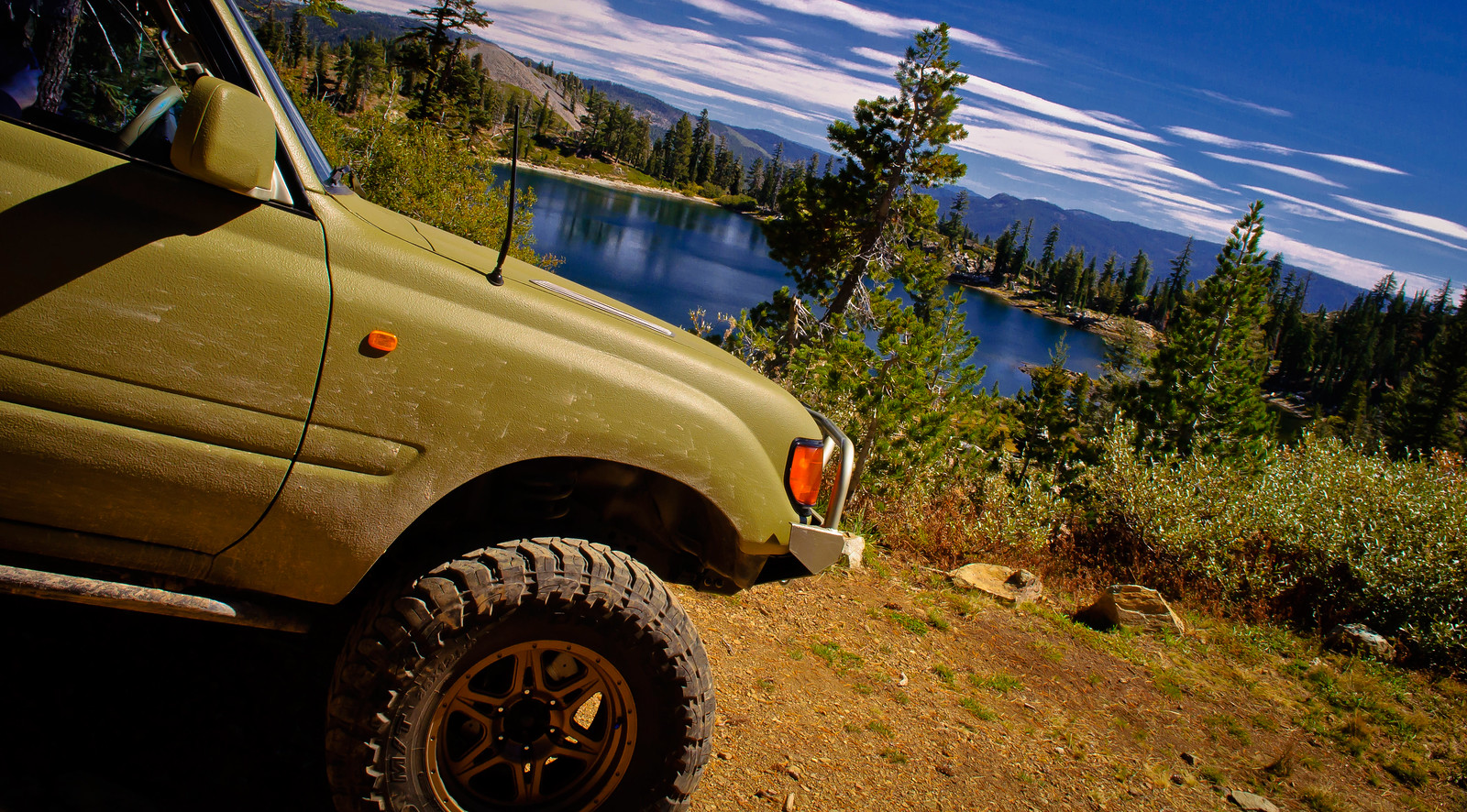
And we finally reached out destination, Little Deer Lake! This is where we would set up camp. Time for pics!

9993735864_cbd6251da6_h.jpg


9993780766_822c12725e_h.jpg


The dog stopped moving long enough for just one photo

9993731585_b4dd925c83_h.jpg


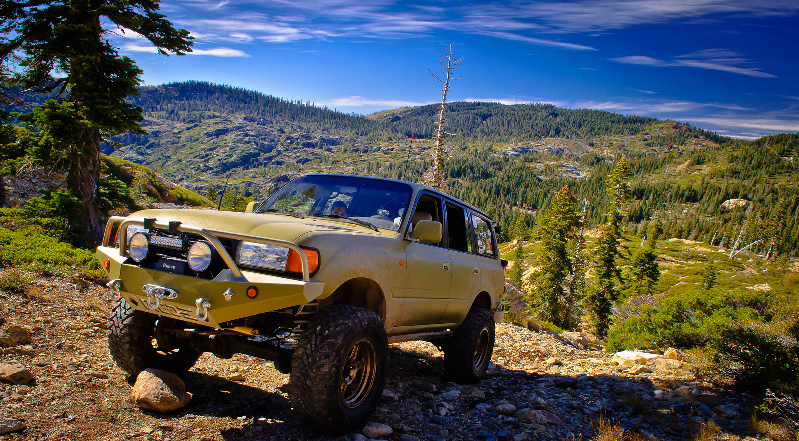
Such a gorgeous lake. We had it all to ourselves. Didn't see one other rig running this trail the whole time we were there!

9993727024_2bf9437f03_h.jpg


Set up camp right in front of the water!

9993774616_e27d4654e6_h.jpg


The next day it was time to pack up and get some more shots in front of the lake with the early morning light.

9993772086_1cd61c263e_h.jpg


9993770786_bc51cb8e7b_h.jpg


Why we do what we do!

9993853823_483315ef3e_h.jpg


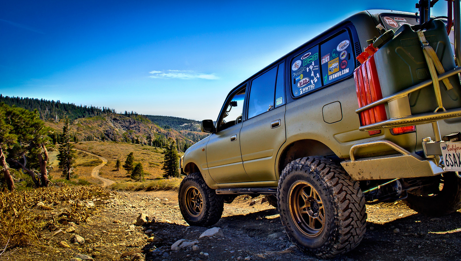
The trail after Little Deer Lake wasn't bad at all, just a few more steep rocky climbs as we made our way down towards the beginning of the loop.

After passing the junction we continued on south on the Deer Lake trail. Fun little drive, moderate, suitable for stock rigs. When we reached Deer Lake, we took the short downhill drive to the parking area which is a surprisingly steep downhill climb!

9993852063_67c976ba87_h.jpg


9993716264_445b60911f_h.jpg


9993849043_f135029d47_h.jpg


After Deer Lake we continued on south ever further till we eventually came up on the Sierra Buttes OHV trail. This would take us to the Sierra Buttes lookout tower. This is an easy drive suitable for anything except a car but you will climb A LOT of ground. I ran the whole thing in L/L and truck was definitely working to get to top. You'll eventually come to a parking area but if you keep going you can skip some of the hike. You'll reach a locked gate where we parked the truck and hiked on up. I'm not a hiker so this was a tough 3/4 mile climb.

You'll eventually reach the stairs to the lookout tower. 8,600ft!!!!!!!!

9993847333_f84b91ab9d_h.jpg


The unmanned tower that is now open to the public

9993707295_7095929293_h.jpg


The breathtaking views. When you're this high up, there's not much you can't overlook. It was freezing up here, but well worth the effort.

9993714205_83c08c9c07_h.jpg


9993706874_e20fe318e9_h.jpg


And one last picture before climbing down!

9993836283_bf070c2801_h.jpg


Made the easy drive down the mountains and aired up before heading on home. We drove out through Highway 49 which was a beautiful drive all in itself. We had never driven down this stretch of 49 before so it was worth the long detour.

All in all, great trip. If you live in the area, this is a MUST DO!

9993834373_cbb07fe9a8_h.jpg
 
Yeah, that post is what made me want to go up there! I just ended just going to paradise and back.. Miss my truck already!! But I know the wait will be worth it! I will hit y'all up again when it is ready for pickup and we can make a weekend trip of it and hit the trails on way back down...
 
So, heading up to this general area this coming saturday if anyone wants to join... I'll be picking up my rig at 8 am (a buddy in a capable 4rnr is driving me) in paradise, and will most likely have to make it a day trip only. We can head to snake lake trail head around 10/11am and meet up, or do another local trail? Suggestions?
 

Users who are viewing this thread

Back
Top Bottom