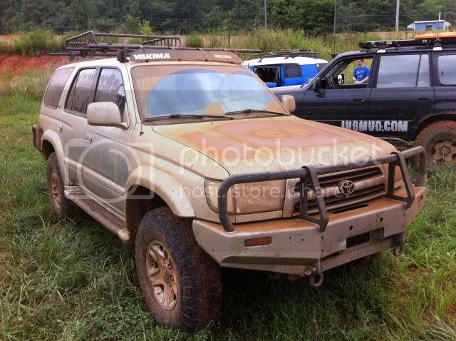
*******August Wheeling Trip (aka, Over The Mountain Tour)*******

This site may earn a commission from merchant affiliate
links, including eBay, Amazon, Skimlinks, and others.

Great time wheeling and meeting new folks as well as seeing some old friends. It was great to finally put some faces with some MUD names. Great food and the best weather we could have asked for.
Thanks to Woody as well as others in my time of need on the track.

Thankfully I made it home before my wife and I got the truck washed before she made it home. ;)
Looking forward to getting out again for Logan's run next month.
 
HAHA ... "I hear creasing" Classic .

Hate I missed it, but looks like a great time all around as usual.
Glad you guys didnt have the rain we had down here.
 
Sad I missed it too. Hope next year will be a little calmer so I can make more events.
 
Few pictures from this weekend:


Saturday morning:


So glad I was in front of the roaring tractor most of the day.

Double 40's!

Fun by all!

DigDug getting dirty


Had a little too much fun:


Proof that the man the myth the legend worked on my vehicle.


Just before most of us left:


From this:

To this just before my wife made it home. Thankfully she let me take her DD for the weekend. :bounce:


I should have a few videos up on youtube in the next day or two. Here: http://www.youtube.com/user/matdean2002ec/videos
 
Ill post this up since its badass i don't think will's gonna...

When Brian gunned it to keep from tumbling backwards on 7. I wish i saw all y'all on that trail.
 
Haha, Dugan talked me out of doing 7, so I decided we'd do 23 instead!


Yeah when Asher, Steve S, Lenny, and I skipped on 7, we sent Asher up 23 to test the waters. He stopped right before that tree/root that got your door and came back down. But I like way you powered through to the top.
 
Which reminds me...the park map needs to re-evaluate some of those ratings. 23 was listed as an intermediate. Maybe we should have taken the chainsaw to that root. ;)

i wouldnt mind if we all woke up and that stump had mysteriously disappeared lol.
 
Which reminds me...the park map needs to re-evaluate some of those ratings. 23 was listed as an intermediate. Maybe we should have taken the chainsaw to that root. ;)

They need to re-do that whole map. There's a bunch that Michael and I did in his 40 that aren't even on the map. Not to mention a bunch that are labeled "intermediate" are certainly what most would consider "difficult".

Sent from another Galaxy
 
Can you say SAS???
 
Send me what you think should be changed. I might be making a new map for the park.

Can everyone else send me their stuff too?

I didn't have my truck so I can't really weigh in too much. I'll be at the November run and I'll be happy to do some "field research" and report back. :grinpimp:

Sent from another Galaxy
 
Send me what you think should be changed. I might be making a new map for the park.

Can everyone else send me their stuff too?
I think Mike ran the two primary trails that I know of that aren't on the map, so either of us could give you that info. Do you just need the basic area of where the trails are so you know where to look for them? Also, do you just walk the trails, especially the extreme ones that wouldn't be kind to your FJC, or do you need a volunteer that's willing to drive those? ;)
 
John and I kept finding the same dang trail...had a 1 on it!
 
I think Mike ran the two primary trails that I know of that aren't on the map, so either of us could give you that info. Do you just need the basic area of where the trails are so you know where to look for them? Also, do you just walk the trails, especially the extreme ones that wouldn't be kind to your FJC, or do you need a volunteer that's willing to drive those? ;)

If you have a GPS log that would be great. Please email to Steve@SoutheastOverland.com.

Anything that I or someone from my cartography firm GPS's might have to be walked due to the higher precision equipment we run. Depending on the data collection environment and accuracy needs I might drive some. Just depends.
 
I agree the map needs some serious updating. There are a number of trails not shown or mis-labeled. 42 and everything on that side of the park is not shown, "the jungle" and all that area.

I could probably borrow the tremble from my office for the November ACC run. I could probably get a basic shape file into ArcGIS 10.1 tied to our main map, however:
-I know just enough about the unit to be dangerous
-We are using a very old unit with ArcPad 7.1.1
-Our unit is only sub meter and I am not sure how to make the vertical correction since we generally just use it for spotting manholes, lines and valves, nothing fancy.
-I would guess that you could use that start with and build off of, but I would hate to give you crappy info that would only make you hate me. :meh:

Let me know if any of that sounds like it would be usable.

-Matthew
 
I have a very outdated Garmin that I use in the mini. It will trace the route but I don't think it's very accurate. I've driven the same trails a bunch of times and the lines don't usually overlap. Also it loses signal pretty easy.

So since I have no technical knowledge, how about I drive and you map Matthew?

Sent from another Galaxy
 

Users who are viewing this thread

Back
Top Bottom