Northern CA: Gold Valley~Snake Lake~Deer Lake~Sierra Buttes (1 Viewer)

This site may earn a commission from merchant affiliate
links, including eBay, Amazon, Skimlinks, and others.

Joined
Aug 12, 2011
Threads
125
Messages
5,002
Location
Sacramento, CA
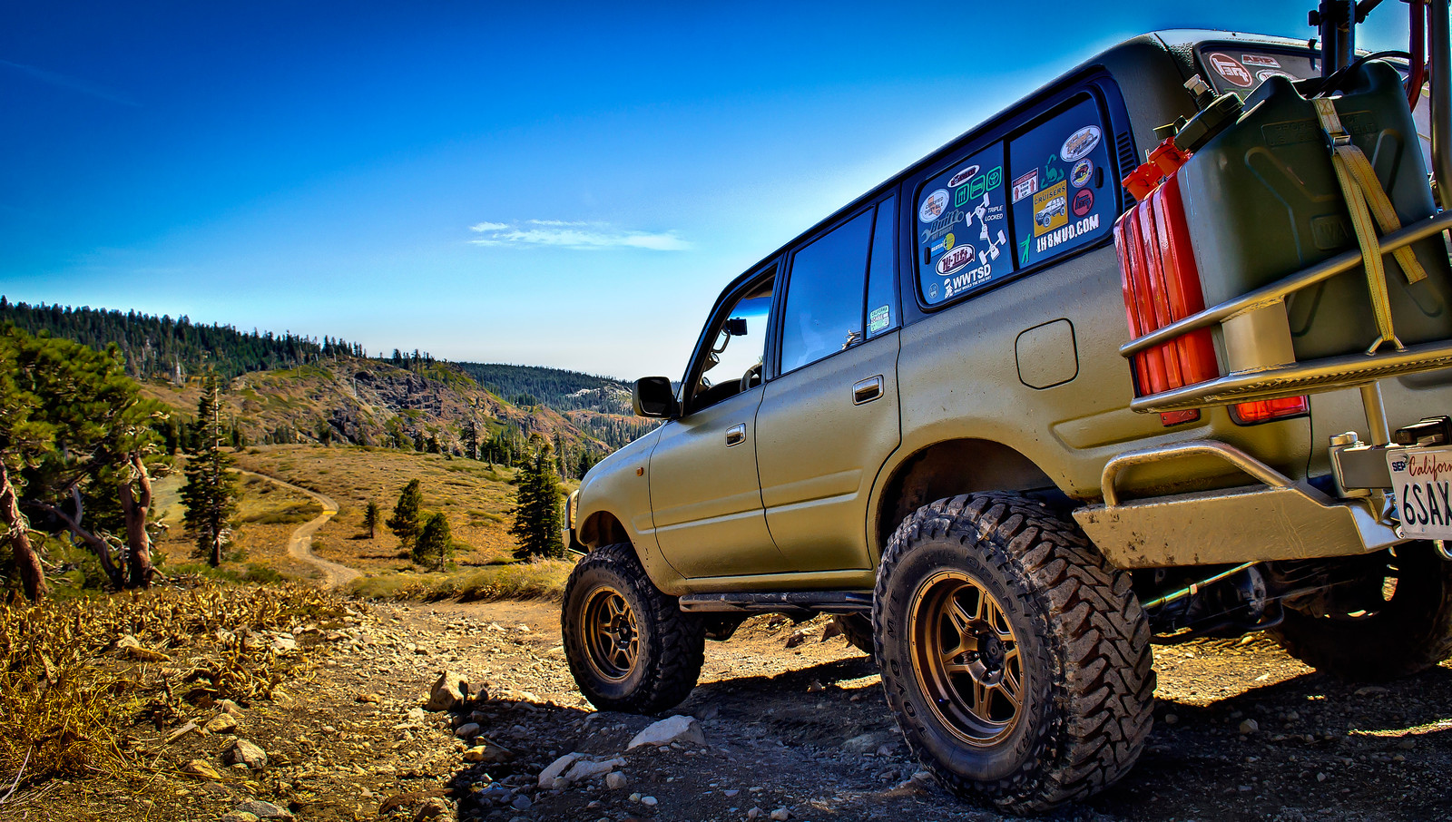
Just returned from a really neat wheeling trip for my bday weekend. Wife asked why we couldn't go out for dinner and drinks like normal people. Well, I think she should know by now, I'm not normal like most people! I've been wanting to run Snake Lake for the longest time so I decided now was the time before it started to get really cold. It was an amazing experience. Will definitely be one of the more memorable trips.

Here's a map that I marked up with pink/yellow highlighting. We started up north in the Plumas Eureka State Park and went south on the Gold Valley OHV trail. We then took the short junction from the Gold Valley trail to the Snake Lake trail and ran that trail south to Little Deer Lake. I didn't do the full loop since it was just us and I didn't want to run into trouble on these desolate trails. Half of the loop proved to be very challenging. The last day we continued south on the Deer Lake trail and eventually out to the Sierra Buttes lookout tower.

9515915895_49df785796_k.jpg


This is the Gold Valley OHV trail. This is a very easy mellow drive perfect for stock rigs with amazing views.

9993768475_2399ec303b_h.jpg


9993814026_643c8e4347_h.jpg


9993812586_98eefab2b2_h.jpg


9993811046_8bf0b1cd12_h.jpg


9993758964_8121648102_h.jpg


You'll pass several lakes on the Gold Valley trail. These are Spencer Lakes. You can't drive to them, but you can hike down if you like.

9993807286_e97e55ac37_h.jpg


And Wades Lake

9993805596_947017676e_h.jpg


9993756825_d4eb430c03_h.jpg


Eventually you'll come up to trail that goes left (east). This is the short junction that leads you to the Snake Lake trail. From here on out the trail will get nasty. Even on this short section of trail I needed both lockers and got hung up on a few large boulders. And of course, I only stopped to take pics after I passed the hard parts :)

9993755205_d31c8f00c1_h.jpg


9993753545_2758a23abe_h.jpg


9993752095_625f7fb75f_h.jpg


And here's a short clip of my wife trying to spot me in between a large boulder and some exposed roots.


At the end of this junction trail you'll come to another intersection. Right (south) takes you down to the shore of Snake Lake and further on down, Little Deer Lake. This would be running the trail counterclockwise. Going straight takes you clockwise on the Snake Lake loop, which is the difficult route.

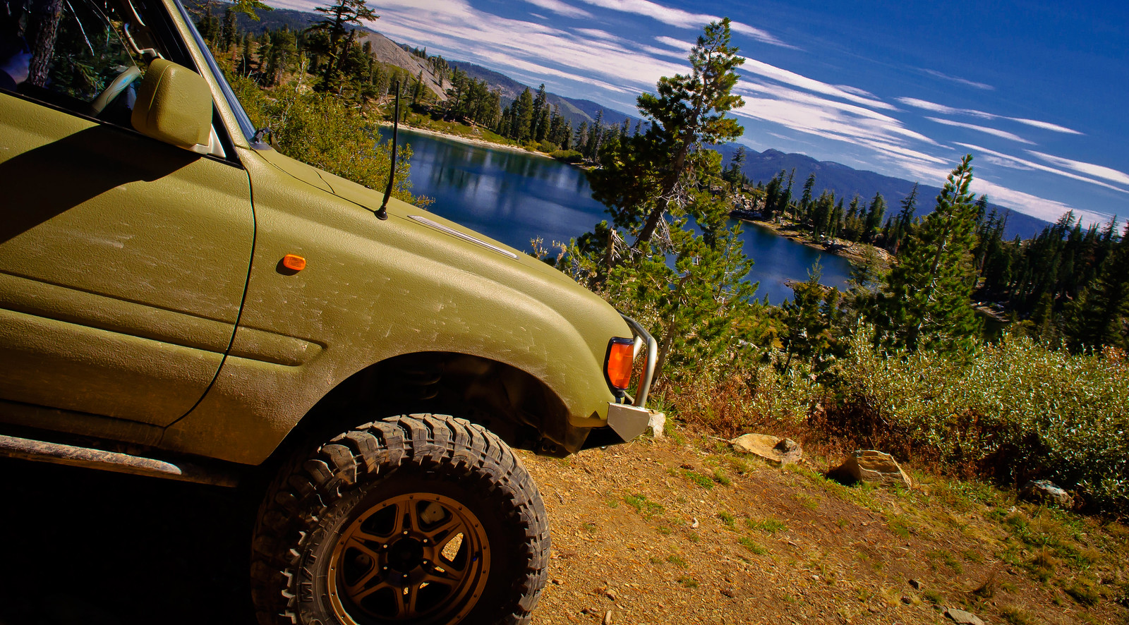
The beautiful Snake Lake

9993751325_3659a5b9f6_h.jpg


9993746895_bddcf7c4d2_h.jpg


9993745105_5514bc6235_h.jpg


9993789866_cc39ec13f9_h.jpg


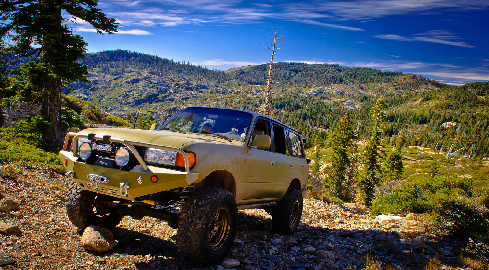
After leaving Snake Lake you'll have a few very steep climbs with loose rocks. I didn't even try climbing these without both lockers on. Didn't want to get in trouble out here alone.

9993872643_323e12f044_h.jpg


And another short video clip. You probably can't get a feel via video of just how steep this was!

 
Last edited:
[continued]

And we finally reached out destination, Little Deer Lake! This is where we would set up camp. Time for pics!

9993735864_cbd6251da6_h.jpg


9993780766_822c12725e_h.jpg


The dog stopped moving long enough for just one photo

9993731585_b4dd925c83_h.jpg


Such a gorgeous lake. We had it all to ourselves. Didn't see one other rig running this trail the whole time we were there!

9993727024_2bf9437f03_h.jpg


Set up camp right in front of the water!

9993774616_e27d4654e6_h.jpg


The next day it was time to pack up and get some more shots in front of the lake with the early morning light.

9993772086_1cd61c263e_h.jpg


9993770786_bc51cb8e7b_h.jpg


Why we do what we do!

9993853823_483315ef3e_h.jpg


The trail after Little Deer Lake wasn't bad at all, just a few more steep rocky climbs as we made our way down towards the beginning of the loop.

After passing the junction we continued on south on the Deer Lake trail. Fun little drive, moderate, suitable for stock rigs. When we reached Deer Lake, we took the short downhill drive to the parking area which is a surprisingly steep downhill climb!

9993852063_67c976ba87_h.jpg


9993716264_445b60911f_h.jpg


9993849043_f135029d47_h.jpg


After Deer Lake we continued on south ever further till we eventually came up on the Sierra Buttes OHV trail. This would take us to the Sierra Buttes lookout tower. This is an easy drive suitable for anything except a car but you will climb A LOT of ground. I ran the whole thing in L/L and truck was definitely working to get to top. You'll eventually come to a parking area but if you keep going you can skip some of the hike. You'll reach a locked gate where we parked the truck and hiked on up. I'm not a hiker so this was a tough 3/4 mile climb.

You'll eventually reach the stairs to the lookout tower. 8,600ft!!!!!!!!

9993847333_f84b91ab9d_h.jpg


The unmanned tower that is now open to the public

9993707295_7095929293_h.jpg


The breathtaking views. When you're this high up, there's not much you can't overlook. It was freezing up here, but well worth the effort.

9993714205_83c08c9c07_h.jpg


9993706874_e20fe318e9_h.jpg


And one last picture before climbing down!

9993836283_bf070c2801_h.jpg


Made the easy drive down the mountains and aired up before heading on home. We drove out through Highway 49 which was a beautiful drive all in itself. We had never driven down this stretch of 49 before so it was worth the long detour.

All in all, great trip. If you live in the area, this is a MUST DO!

9993834373_cbb07fe9a8_h.jpg
 
You did take your wife out to dinner. WAY OUT!

I had a similar experience as you. That is an awesome area that not too many people know about.

Thanks for the great pics and your rig is awesome too!
 
Been to the area a bunch of times mountain biking, but I've never wheeled to all those places. Planned it once and broke down out in the state park, The rescue and tow was an adventure by itself.

Thanks for sharing.
 
haha I can almost see my house from some of those sierra butte pics! lol im surprised that you didn't see me out there on Saturday, I was running around in my rig lookin for deer. did you meet keith with the Blue FJC in camp #1 at gold lake OHV campsite?
 
Awesome, I've been wanting to go up there.. well.. pretty much forever. I still have not done it. Maybe we can still get up there before the snow falls this year. Looks like it's totally worth the drive up!
 
Awesome, I've been wanting to go up there.. well.. pretty much forever. I still have not done it. Maybe we can still get up there before the snow falls this year. Looks like it's totally worth the drive up!


Shouldnt get too much snow for another 2-4 weeks hopefully.
 
haha I can almost see my house from some of those sierra butte pics! lol im surprised that you didn't see me out there on Saturday, I was running around in my rig lookin for deer. did you meet keith with the Blue FJC in camp #1 at gold lake OHV campsite?
Good stuff! No, didn't see an FJC out there, but I never made it out to the Gold Lake area. I did run into a sweet looking FJ62 on what looked like 37s. Saw him on the trail south of Deer Lake.

Thanks folks :)
 
Good stuff! No, didn't see an FJC out there, but I never made it out to the Gold Lake area. I did run into a sweet looking FJ62 on what looked like 37s. Saw him on the trail south of Deer Lake.

Thanks folks :)

Nice! Next time you go up shoot me a message and ill be more than happy to wheel with you sometime if you wantm I live in quincy about 45 mins from there
 
That area is beautiful. My 60 and I know it well. But how did you get your (very nice) 80 down to the lake front? The Forest service has the trail to the waters edge of Deer Lake closed to 4x4's.
 
Nice! Next time you go up shoot me a message and ill be more than happy to wheel with you sometime if you wantm I live in quincy about 45 mins from there

That sounds like fun! Have there ever been any MUD-organized trips to this area?

That area is beautiful. My 60 and I know it well. But how did you get your (very nice) 80 down to the lake front? The Forest service has the trail to the waters edge of Deer Lake closed to 4x4's.

Thanks! I didn't go all the way to the shore of Deer Lake. Those were taken by the parking area. I did see a difficult-looking staircase trail down to the shore, but it looked like it was closed and hadn't seen any vehicle traffic in sometime, so I stayed out. Good to know it's actually closed!
 
I've been there a couple of time. It's pretty mild wheeling except Snake Lake.
Great pictures and video!
 
And another short video clip. You probably can't get a feel via video of just how steep this was!


That's an insanely steep trail. Once committed, you have to finish, no turning around.

Regards

Alvaro
 
Hi all,

Cool Trip! thanks for sharing with us jcardona1! :)

Regards,

Alan
 
Nice write up and pics!! :cheers:

I think this might have to be one of my trips next summer... How were the mosquitos, and bees?
 
Nice write up and pics!! :cheers:

I think this might have to be one of my trips next summer... How were the mosquitos, and bees?
Non-existent, at least for this time of year.

Thanks fellas :cheers:
 
Nice write up and pics!! :cheers:

I think this might have to be one of my trips next summer... How were the mosquitos, and bees?

Mosquitos were nearly non existent when I was up there this year too, but the year prior they were pretty bad. Definitely don't let it change your plans.
 
skeeters aint bad at all up that high, go down 3k feet and they get thick in that area once the first frost hits they mostly disapear
 

Users who are viewing this thread

Back
Top Bottom