Another 4.18.09 Anza Thread

This site may earn a commission from merchant affiliate
links, including eBay, Amazon, Skimlinks, and others.

Good report and the pictures bring it to life.

I like this pic of Brent doing the Spiderman thing:
Wall crawler :D
ggg.webp
 
wow, a hybrid between a lizard and a ferret...! :eek:
 
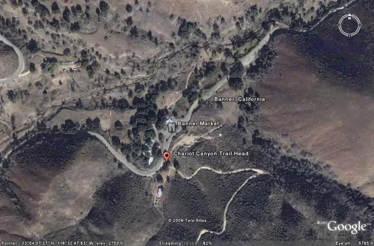
I forgot to ask, how was it finding the entrance to Charriot / Rodriguez Canyon in Banner? Was their any distinguishing sign or trail marker?

It's as easy as it gets. It is almost directly across the road from the Banner Market. About 100 yards up the road is a cattle gate which you'll need to open, be sure the last person through closes it. I have seen cones in front of this gate which locals use to discourage travelers. It is a public road but passes through private land until you reach Anza Borrego State Park boundries.

Chariot Canyon Trail Head.webp

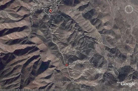
When you reach the fork go left(north) for Rodriquez or stay straight (south) for Chariot Cny aka Mason Truck Trail.

Rodriquez Canyon Fork.webp
Chariot Canyon Trail Head.webp
Rodriquez Canyon Fork.webp
 
Last edited:
It's as easy as it gets. It is almost directly across the road from the Banner Market. About 100 yards up the road is a cattle gate which you'll need to open, make sure the last person through closes it. I have seen cones in front of this gate which locals use to discourage travelers. It is a public road but passes through private land until you reach Anza Borrego State Park boundries.


Dead on accurate description! Not too far in there's a 'Y' A very nicely graded road heads up the hill and to the left. A less worn path goes more straight. We took the later, which was Chariot. We figure that nicely graded road was Rodriguez.
 
I took another look at the map last night, because I want to try and get out to Borrego one more time in May before it gets too HOT. And I noticed another trail off of Chariot Canyon. In the direction you guys were going it would have been on the right side and it is an actual Jeep Trail called Mason Valley Truck Trail. It is a dead end that leads to the Pacific Crest Hicking Trail. But it may be a fun little off shoot to do, turn around and finish Chariot.
 
My GPS showed us on Mason Valley Truck Trail down lower. Just assumed Chariot Canyon and Mason Valley were one in the same. We did cross the Pacific Crest Trail on the road we traveled - see Scott's pics for the marker. Scott's Google Earth post shows clearly where Rodriguez cuts off to the left and up the hill.
 
My GPS showed us on Mason Valley Truck Trail down lower. Just assumed Chariot Canyon and Mason Valley were one in the same. We did cross the Pacific Crest Trail on the road we traveled - see Scott's pics for the marker. Scott's Google Earth post shows clearly where Rodriguez cuts off to the left and up the hill.

Correct, Chariot Canyon and Mason Valley are one and the same.
 
I know Pacific Crest Trail crossed Both Rodriguez and Charriot. But there is a specific off chute about 3/4 of the way on Chariot before you make the hard left connecting back up with Rodriguez. And on my map there is an arrow only pointing to MVTT.
 
I know Pacific Crest Trail crossed Both Rodriguez and Charriot. But there is a specific off chute about 3/4 of the way on Chariot before you make the hard left connecting back up with Rodriguez. And on my map there is an arrow only pointing to MVTT.

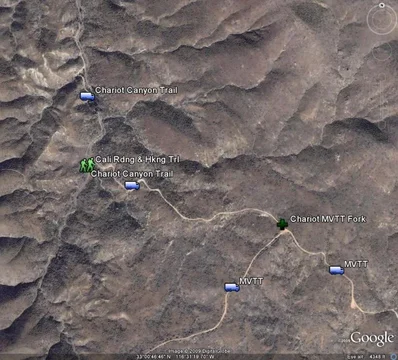
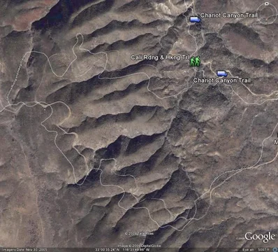
Not to confuse but as Chariot continues south it becomes MVTT at the fork or T intersection I believe you are speaking of. So if you turn right you are on MVTT and if you continued straight you are also on MVTT. There is another fork that goes west(right) a bit earlier that joins back to the MVTT. I don't see a name except the California Riding and Hiking Trail.

Chariot Cnyn Map.webp

Chariot Cnyn Map LG.webp
Chariot Cnyn Map.webp
Chariot Cnyn Map LG.webp
 
Back
Top Bottom