

Kootenay trails

This site may earn a commission from merchant affiliate
links, including eBay, Amazon, Skimlinks, and others.

Joined
Dec 14, 2007
Threads
55
Messages
2,157
Location
Nelson, BC
Alpine Mine

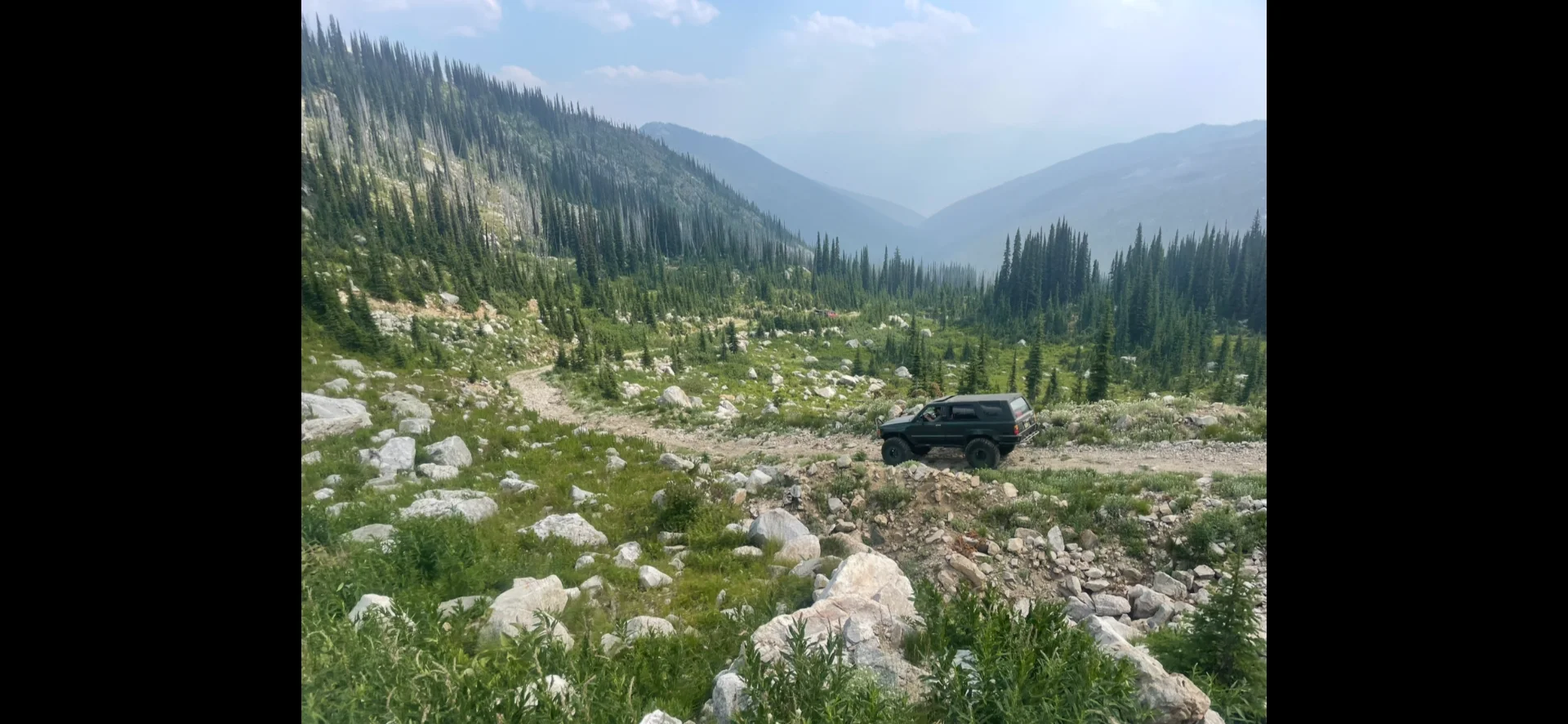
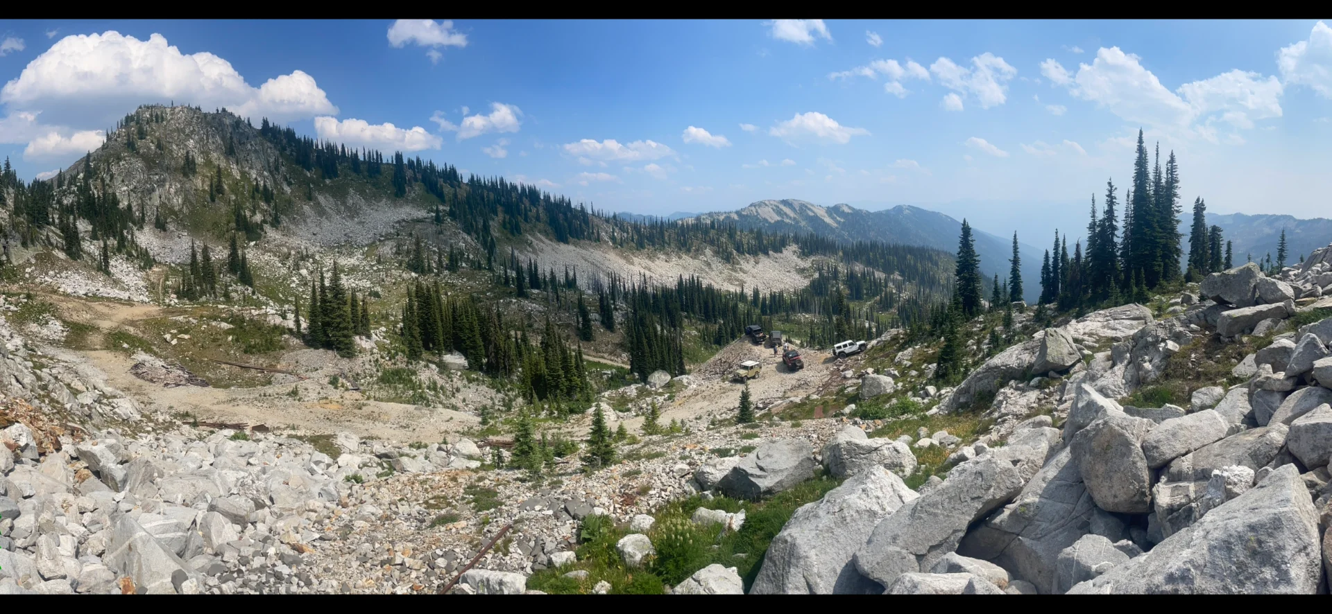
So my buddy JT organized a day trip to a local spot near Nelson about a month ago. The old Alpine mine. Yet another road on the deactivation list. Less used than Rady but still would be a shame to lose.

My 40 was having fuel starvation issues in the heat between vapour lock and a plugged fuel filter. Sucks having mech trouble on a jeep run that’s being recorded but oh well. He didn’t give me too much of a hard time about it

IMG_3672.webp
IMG_3673.webp
IMG_3674.webp
 
Great Video. How long from pavement to the top? Couple of hours or more?
 
Great Video. How long from pavement to the top? Couple of hours or more?

Made a day of it but it’s not that big of a trip. Left from the boat launch at the big orange bridge around 1030. Probably just after 1100 from where we aired down just past the private residences at Sitkum. Got back to pavement anired up around 5pm. that was at a pretty easy pace with a bunch of short stops and a big stop up top at the mine. Some blow down to be cleared and for me time under the hood diagnosing why I was having increasingly more issues with fuel. Trail itself is getting quite brushy. A couple rough spots but overall nothing difficult.
 
Come on up. Would be fun to do some more wheeling with other cruisers.
It’s funny though because I have been spending more and more time on the island to get out on the sea
DFO fishing restrictions have gotten so bad kind of wonder if it’s worth it anymore for the price of gas to watch the local school out with gill nets.

Oh, and count on me letting you know when I’m coming in all honesty. Early mid- November isn’t too bad is it should be ahead of the snow?
 
Totally agree about the fishing regs. They threw residents under the bus to keep commercial net fisheries going (expanded for FN commercial quota) and to look like they are doing something for killer whales. But there is no way hook and line recreational fishing is the cause of the problem. If we didn’t have a little place on the water to go to north island I’d probably not bother.

Lately the snow here has been late. But some years it really piles up in November.
 
Do you mind sharing a pin, I'm trying to get to as many of these cool places before they are deactivated. Luckily crossed Rady off my list.
 
Trout Lake

And speaking of Rady. I’m not sure where things currently stand. Seems they fully intent to remove that access. Not entirely sure why. I guess they say it’s partly concern over sleds in mtn caribou habitat. It’s just such a beautiful area. The road itself looks stable enough and despite the fatal accident last year isn’t all that sketchy or particularly dangerous.

IMG_2925.webp

IMG_2874.webp


The other road access to silvercup ridge gets much more narrow with longer exposed slopes. For now it seems it isn’t being threatened but the trend is worrying

IMG_2998.webp

IMG_3019.webp


Another major trail loss up there was the road access up Healy creek that was barricaded and I doubt will be reopened. Doesn’t help that the condemned bridge is at the park boundary

IMG_3045.webp
 
Afternoon solo run just to get out of the house. Local trail I’ve heard called the slabs. This one’s not on the chopping block as far as I know. Fun trail. Tight forested climb up to exposed granite. Parts of the trail remind me of eastern california. Supposed to loop back to a snowmobile cabin. Ran out of time and since I was alone and didn’t really know what was ahead turned around before finishing the loop. Will go back again some time

IMG_4510.webp


IMG_4500.webp


IMG_4503.webp


IMG_4498.webp


IMG_4471.webp
 
Ok then. May as well add these here. I might have shared some of these last year.
Was driving the BJ60 then. Again with JT and some jeeps. Drone shots are his.

Duncan/meadow
524815869_122148512768747490_631615604168129755_n.webp
IMG_7399.webp

Buchanan
IMG_7428.webp
IMG_7416.webp
524448512_122148511964747490_7216940578019116921_n.webp
 
Great pics and weather this time of year! :beer:
 
Thanks Rob. And yes weather and clear skies in Sept/Oct can be really nice. Especially now with the larches and other trees in full fall colour. But I should add that the last two posts with the 60 are from summer. August 2025. Just put them up now to highlight some of the better areas where old mine roads get you high up the mountains. Sometimes we are lucky where snow melts before the fire season/smoke gets really bad.

So in regards to the trail I started this thread with up Sitkum Creek/Alpine Mine, it is now posted to be removed in summer 2027. It already has a lot of cross ditches on it from before so the plan must be for more drastic deactivation. Rady on the other hand went to tender but they received no bids to do the machine work. So for now that's good news. Will see if the next two weeks changes anything about its future.
 
Last edited:
Don't want to get more political but apparently the list of 'secret land giveaways' is long and extensive throughout BC
that our current slimeball is demanding NDA for all involved so no one knows the land is gone until it's gone. This is
the hidden fight that Colin is up against. I admire him for his choice to deal with this straight on. I couldn't.
 
I want to head back out that way and spend a few days at Lake Koocanusa, it looked incredible! We had taken a "shortcut" through some FSR (teepee creek I think it was) at Yahk BC, that bypassed Cranbrook and came out at the Trans Canada Trail and bridge over the lake. Really should have stopped and taken some pics, it was beautiful.
 
Back
Top Bottom