Jacumba Trail Run (East of San Diego) June 23

This site may earn a commission from merchant affiliate
links, including eBay, Amazon, Skimlinks, and others.

Awesome! I totally love the 1st gen 4runner. I miss my 89.

Frank
 
Here are some photos I took. If you look close you can see the illegals being escorted back to the border patrol vehicles. We had a great turn out, definitely a fun trip!

image-1269129172.webp


image-2690666763.webp


image-488386106.webp
image-1269129172.webp
image-2690666763.webp
image-488386106.webp
 
I had a lot of fun and it was great to meet everyone!

I'll post any of the good pics I have tomorrow, I'm at work on Sunday...
 
We had a nice turn out today. 9 rigs got to experience valley of the moon and Table Top.

Here is the Route (Note, we drove in/out of Valley of the Moon Twice to pickup some fluids to fix a mechanical issue on the FJ-40..)
Jacumba - Offroading trip | EveryTrail

Here are a few photos from today.


Chuck's stock Lexus did really well!


ON the way to Valley of the Moon


Convoy of Toyotas!


Nice Looking FJ-40!


Great pics Craig.....

I think we all learned a valuble lesson to always check all your hoses before you go out and definately pack extra vehicle fuilds with your tool kit.....LOL
 
Does anyone have more pictures from the run?
 
Does anyone have more pictures from the run?

Yes, I do. I'm on a business trip and will post them when I return this weekend. It was lots of fun and it was great meeting everyone.
 
OK, here are some of my pictures from the trip. I'm not sure how some of you upload more than three pictures so I will make multiple posts...

Here is a panoramic shot from the top of Elliot Mine looking down into the Valley of the Moon and into Mexico
DSCN1697Panoramic.webp

Two LC's parked below Elliot Mine
DSCN1698RevA.webp
DSCN1698RevA.webp
DSCN1697Panoramic.webp
 
Two shots at the end of the Valley of the Moon run.
DSCN1699RevA.webp

You can see the trail above the group of guys and behind the power lines.
DSCN1700RevA.webp

Circling the wagons on the Table Mountain run at a spot overlooking Anza Borrego Desert State Park. We were down from 9 vehicles to 8 at this point.
DSCN1702RevA.webp
DSCN1699RevA.webp
DSCN1700RevA.webp
DSCN1702RevA.webp
 
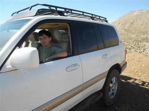
After the desert view point, 4 vehicles continued on to look at a Guzzler. Guzzlers are man made rain water collectors so there is water for the wildlife out there. There are several in the Table Mountain area. I didn't get a picture of the Guzzler... After that stop, 3 vehicles left for home so at that point I gave the keys to my 15 year old son. He took us further west and eventually up a gnarly hill, or as my friend Mark called it a sphincter tightening hill. He did fine but he wanted me to drive it back down...
DSCN1703RevA.webp

Here's my artistic shot looking back east at Table Mountain.
DSCN1711RevA.webp

After that I gave the keys to my friend Mark. He got to take the Hundy up this hill.
2006 Land Cruiser 100 Series, near Table Mountain, San Diego County - YouTube

And then we stopped where this sign was. It was an interesting spot as there were several Native American morteros in the area and there were a lot of pottery shards laying all over the area. Leave the shards there if you ever go.
DSCN1715RevA.webp
DSCN1703RevA.webp
DSCN1711RevA.webp
DSCN1715RevA.webp
 
Nice write up Steve. It sounds like you found some challenging climbs after we left.

Six more weeks and my MBA is done which means I have my weekends back again! Can't wait to do some more runs.
 
I miss san Diego. I was grew up out in alpine. If I move back I'll have to do some trail runs with you guys. Or if you ever road trip to moab here in Utah, I'll have to run a trail there with your club. Great pics and great write up. Sounded fun
 
I've done the Table Top trail last year and it's actually fairly mild, nothing difficult about it that I can remember. It's actually pretty short also, only about 6 miles one way until you hit wilderness where you are not legally allowed to drive your vehicle into.

In my opinion the smugglers cave / Elliot mine trail is more interesting and fun. And both trails are short enough and close enough together that you can do one right after each other in a day trip.
Just reading your post about Table Top ... there's no wilderness boundary but the line you cross is the Anza Borrego Park boundary, at that high spot on a small ridge (32.664831,-116.174959 coordinates on Google Maps). From there it gets very interesting as you travel west and north -- the jeep road is faint but viewable in Google sat. Look in the jeep forums for the "Carrizo Gorge Overlook" -- there aren't very many -- and do the trip someday with some very experienced people. One of the best possible runs ever!

Also, if you want some challenge, once you turn around to come home from the end of the Table Top run, do not return via the traditional route. Where you're supposed to leave the creek bed (32.66549,-116.156827 on Google sat), stay in the creek bed and wind your way for another 10 minutes and leave the creek bed on an obvious but faint trail (32.66549,-116.156827). The climb is steep and a bit technical if you keep to the right when you see a cutoff.

And for a real unknown, stay in the creek at the last coordinates and exit the the canyon at the top of the wash. I haven't done this one and while it doesn't look too steep I'm guessing there is some real rock crawling in that creek bed.
 

Users who are viewing this thread

Back
Top Bottom