
- Joined
- May 8, 2008
- Threads
- 2,178
- Messages
- 2,178
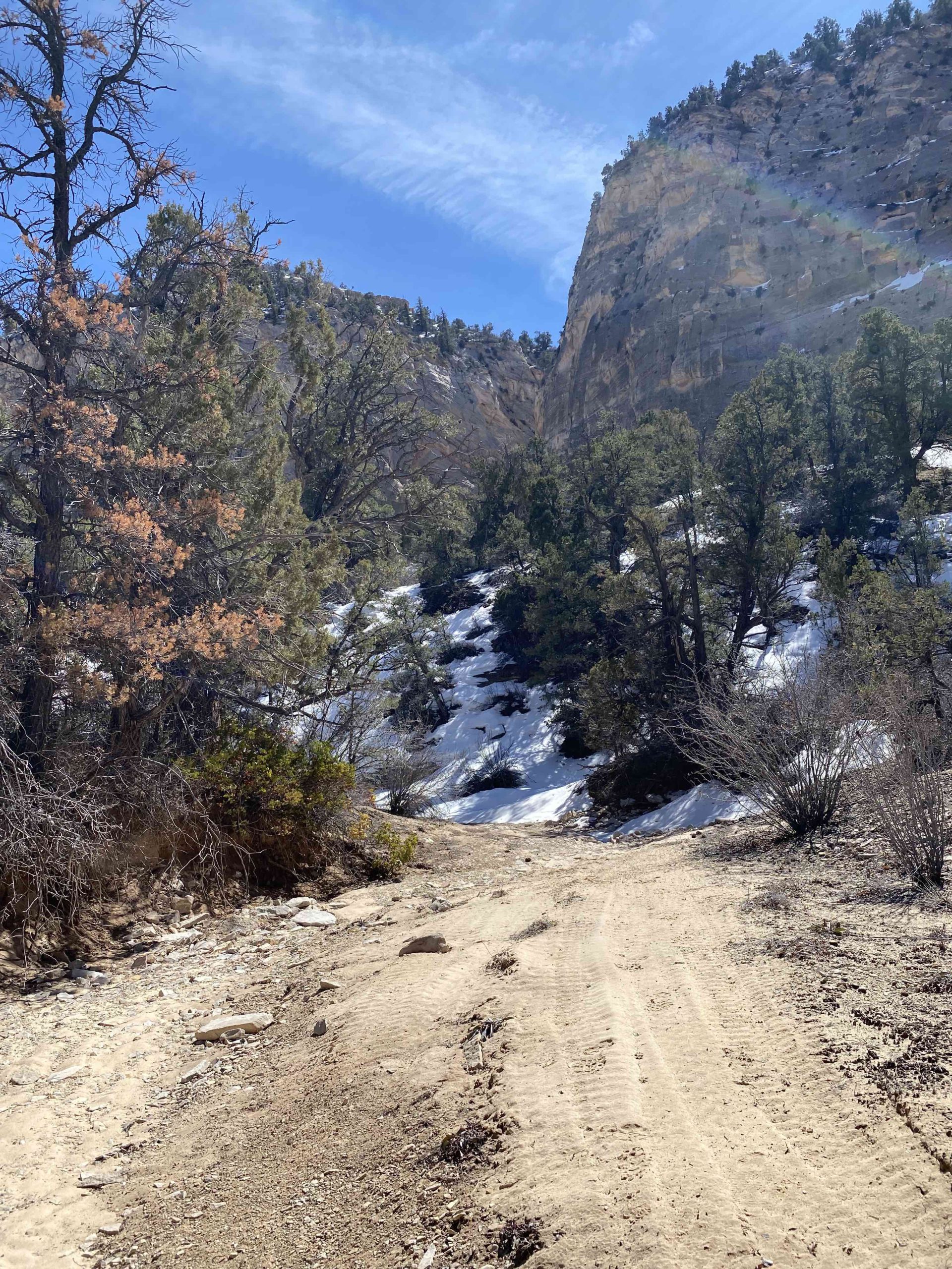
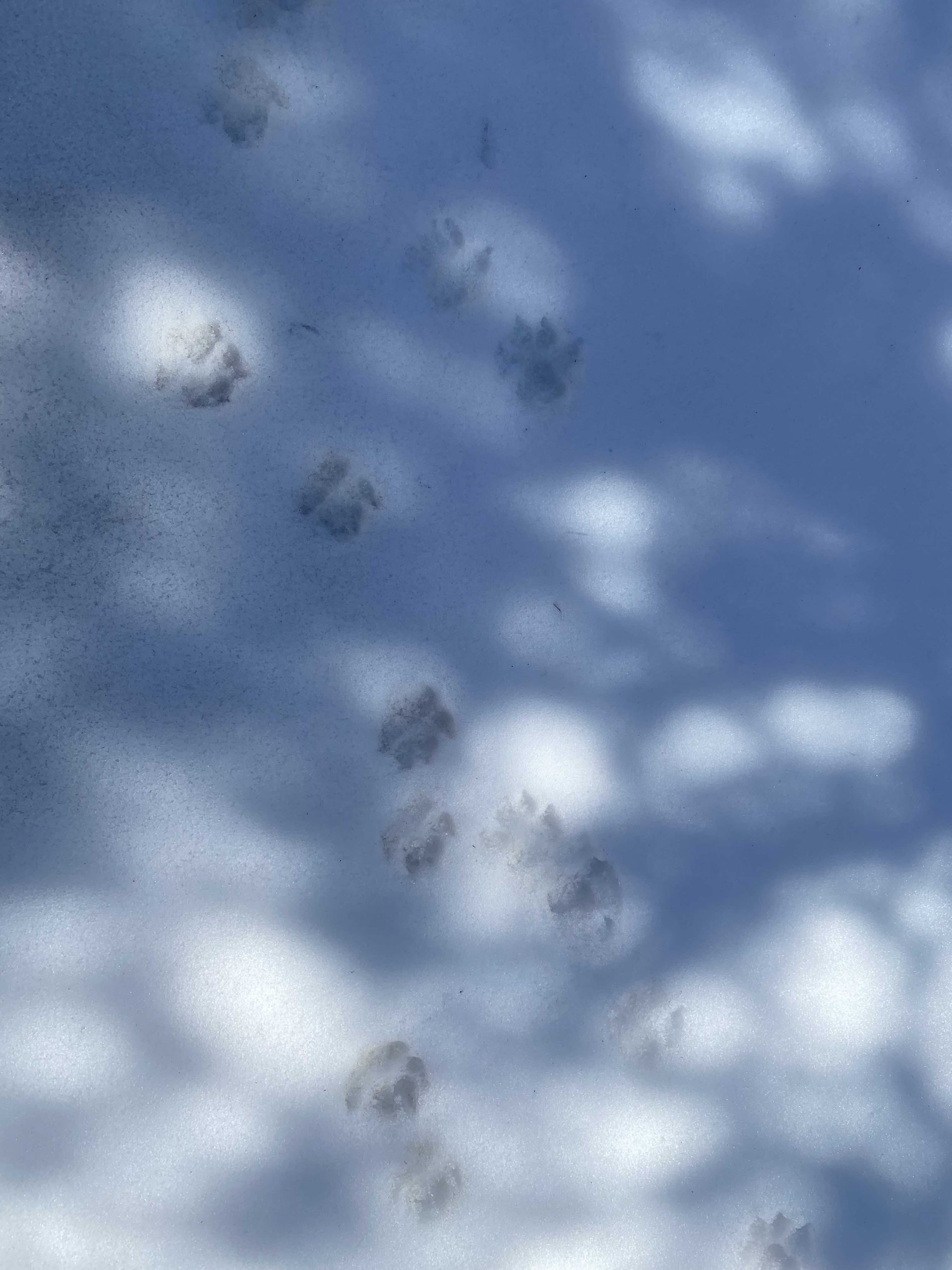
Overview: The Paunsaugunt Area is located just north of Kanab, UT, and the route system in this area provide unique access to landscapes that are similar to those found in Trail Canyon and Zion National Park. Trail conditions range from sandy and smooth to rocky routes that will challenge any machine. BLM Route 107 DNA is another side canyon located north of 107FNA. This trail is another side spur that takes you into a box canyon of white sandstone. In the early spring, snowbanks remained in the route corridor that added extra adventure to the exploration. The untouched snowbanks also created a great opportunity to observe the tracks of the wildlife in the area, such as cougars.
Getting There: This route is easily accessible from the Peekaboo Canyon staging area. You will eventually leave the Peekaboo canyon loop at GPS coordinates 37.17774, -112.54678. You will continue North on this route until you reach GPS coordinates 37.21544, -112.56256. Route 107DNA then leads to the North then Northwest into a canyon.
Route Conditions: There is an Instagram account of a recovery service that documents photos of tourists who take rental cars and less-than-capable vehicles into areas like this. Don’t be that person. A UTV is problem the best type of vehicle for exploring these trails, but a well-equipped Jeep or Toyota will handle the main trails. A full-size truck or SUV will likely have difficulty navigating 107DNA. Be aware that the Peekaboo Canyon Loop receives heavy traffic of all kinds, and will even include those hiking to explore the Peekaboo Slot Canyon. Be respectful of all users of the trail, and be sure to have a tall flag installed on your machine to prevent collisions on blind corners and hills. As a route that travels through the bottom of a deep canyon, it is a mix of deep sand, rock gardens and tight turns.


This route report is part of a larger guidebook BRC is completing to educate users about high-value motorized trails that are at risk of closure if we don’t use them. This guidebook will be called the Lost Trails Guidebook, and has been funded by a generous grant from the Yamaha Outdoor Access Initiative with Jorgensen Powersports as a sponsoring dealer.
Continue reading...
Getting There: This route is easily accessible from the Peekaboo Canyon staging area. You will eventually leave the Peekaboo canyon loop at GPS coordinates 37.17774, -112.54678. You will continue North on this route until you reach GPS coordinates 37.21544, -112.56256. Route 107DNA then leads to the North then Northwest into a canyon.
Route Conditions: There is an Instagram account of a recovery service that documents photos of tourists who take rental cars and less-than-capable vehicles into areas like this. Don’t be that person. A UTV is problem the best type of vehicle for exploring these trails, but a well-equipped Jeep or Toyota will handle the main trails. A full-size truck or SUV will likely have difficulty navigating 107DNA. Be aware that the Peekaboo Canyon Loop receives heavy traffic of all kinds, and will even include those hiking to explore the Peekaboo Slot Canyon. Be respectful of all users of the trail, and be sure to have a tall flag installed on your machine to prevent collisions on blind corners and hills. As a route that travels through the bottom of a deep canyon, it is a mix of deep sand, rock gardens and tight turns.
This route report is part of a larger guidebook BRC is completing to educate users about high-value motorized trails that are at risk of closure if we don’t use them. This guidebook will be called the Lost Trails Guidebook, and has been funded by a generous grant from the Yamaha Outdoor Access Initiative with Jorgensen Powersports as a sponsoring dealer.
Continue reading...