
- Joined
- Jul 20, 2004
- Threads
- 274
- Messages
- 23,233
- Location
- Chandler, AZ
- Website
- www.tontorecreationalliance.org
- Thread starter
- #101
Damn Claudia!!!! Thats a helluva kiss!
Yep, and I followed it up by kissing my rocker today
 , maybe time for sliders?
Follow along with the video below to see how to install our site as a web app on your home screen.
Note: This feature may not be available in some browsers.
This site may earn a commission from merchant affiliate
links, including eBay, Amazon, Skimlinks, and others.
Damn Claudia!!!! Thats a helluva kiss!
, maybe time for sliders?Howdy! Maybe she needs some bumper stock like mine, 1/4 inch thick! I do have some 3" pipe just sitting here. JohnHoly crap, that's legitimate carnage right there!
-Spike (Note: No jokes about women drivers coming from me!

 There were quite a bit of round rocks on top of more round rocks and washed out areas on the hills that made the drive 'interesting' (the term 'annoying' was used, actually). Very nice scenery, and we saw a whole pack (herd? gaggle?) of coatimundi- around 15- cross the trail at one point. Anyone get pics of those? My wife is interested in seeing them. We briefly chased a javalina too- looked like a Chow dog to me, but all I saw was its backside. Great day, great folks. I'm glad I finally got to do this trail, as I've been hearing about it for years but never managed to get out there.


Doesn't look like you ran the extreme hill or canyon?
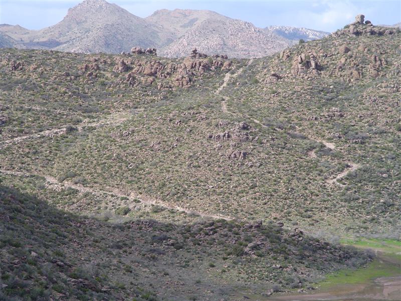
If the picture on page 1 with the cattle pond (or is that a burro pond...) shows Extreme Hill, then yes, we ran that section. We came down the hill as it's shown in your pic.


Doesn't look like you ran the extreme hill or canyon?
We didn't, none of us had ever been there before, so we just explored and had a good time.
We went in off the road that goes by Oak Flat campground and came out on Highway 177. We ran a little loop trail at Oak Flat campground as 'warmup'. Didn't see anything that I'd call 'little Moab'...

There's two hills that hit the cattle pond. The right hill is extreme though you have to know how to find the north side. The left zig-zag is the book part of the trail...the main trail. Which didja do?
Sorry, wrong name.....guess they call it "mini-Lion's Back"...but again, it really doesn't bear any resemblance to the real thing.
Here's a pic from Shotts site:
As usual, the pics never do the obstacle justice.
Sean