
Navigation
Install the app
How to install the app on iOS
Follow along with the video below to see how to install our site as a web app on your home screen.
Note: This feature may not be available in some browsers.
More options
You are using an out of date browser. It may not display this or other websites correctly.
You should upgrade or use an alternative browser.
You should upgrade or use an alternative browser.
Me and my FJ62 are in Big Pine,CA for a month. Where do I go? (1 Viewer)
- Thread starter FJ Silver
- Start date
This site may earn a commission from merchant affiliate
links, including eBay, Amazon, Skimlinks, and others.
More options
Who Replied?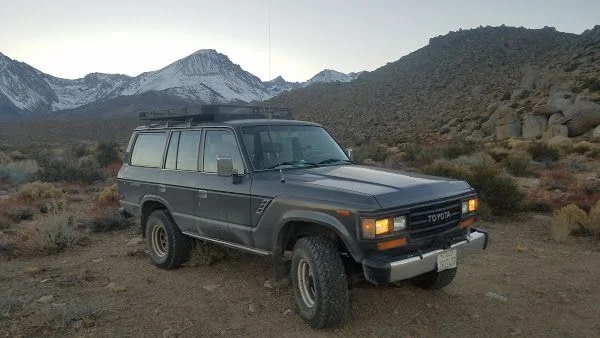


Death Valley!
There are a few Mud'rs in the area, one for sure in Big Pine, but I forget his name. He has a light color camo wrap on his 60.
There is lots to see all around that area.
You can head up Mazourka Peak for a fantastic view of the Owens Valley and Eastside of the Sierra. Papoose Flat is another area, but more remote and better to visit with another vehicle. Onion Valley is close by and a nice drive. Near Lone Pine, the road to Cotton Wood Lakes is paved, but a very scenic road that brings you to a camp ground at 10,000 elevation. The high locations may already be snowed in, so check first.
- Thread starter
- #4
There are a few Mud'rs in the area, one for sure in Big Pine, but I forget his name. He has a light color camo wrap on his 60.
There is lots to see all around that area.
You can head up Mazourka Peak for a fantastic view of the Owens Valley and Eastside of the Sierra. Papoose Flat is another area, but more remote and better to visit with another vehicle. Onion Valley is close by and a nice drive. Near Lone Pine, the road to Cotton Wood Lakes is paved, but a very scenic road that brings you to a camp ground at 10,000 elevation. The high locations may already be snowed in, so check first.
Thanks Doug, I've actually seen him around in his 60! Passed him on the highway and he was in the Bishop Christmas parade, very clean 60.
Let me check out those other drives you suggested. Thanks again.
Death Valley ! Was just in Big Pine/Lone Pine Area after an adventure around DV. Lots of stuff to do....
Cruiserdrew
On the way there
Just head east on the "Death Valley Road" and turn right at the Eureka Dunes turn off. Good camp there. You can circle around behind the dunes and head up Dedeckera Canyon to the top of Steel Pass. Then descend into Saline Valley and enjoy a dip in the hot springs. Good camp there too. Then to complete your weekend, exit the springs, head northe on Saline Valley Road, go out North Pass and back to the Death Valley road and Big Pine.
You could do the whole loop in 1 day, but there is excellent stuff to do out there over a couple of days.
I've taken my FJ62 over Steel Pass basically stock, so you should have no problems. Just take a bunch of water in case you do.
North Pass can be closed by snow if a big storm comes through, but Steel Pass (which is lower) is almost always open.
But that's just the tip of the iceberg. There are miles and miles of tracks, old mines, abandoned ranches within a few hour's drive of Big Pine. Just keep in mind that the weather this time of year can shut down the fun in a hurry.
Another good one day loop from there would be into Fish Lake Valley and pick up the "North Eureka Valley Road". Follow it all the way south to the Death Valley road turn right and return to Big Pine. There are a couple of places along the way to turn left that take you into the Northern end of Death Valley. It's pretty remote and lightly traveled, so you might want to go with a friend. There is no cell coverage.
@John McVicker lives out that way and would be a wealth of info about what to do. The Nat Geo Maps of Death Valley are very helpful in planning a route.
- Thread starter
- #7
Just head east on the "Death Valley Road" and turn right at the Eureka Dunes turn off. Good camp there. You can circle around behind the dunes and head up Dedeckera Canyon to the top of Steel Pass. Then descend into Saline Valley and enjoy a dip in the hot springs. Good camp there too. Then to complete your weekend, exit the springs, head northe on Saline Valley Road, go out North Pass and back to the Death Valley road and Big Pine.
You could do the whole loop in 1 day, but there is excellent stuff to do out there over a couple of days.
I've taken my FJ62 over Steel Pass basically stock, so you should have no problems. Just take a bunch of water in case you do.
North Pass can be closed by snow if a big storm comes through, but Steel Pass (which is lower) is almost always open.
But that's just the tip of the iceberg. There are miles and miles of tracks, old mines, abandoned ranches within a few hour's drive of Big Pine. Just keep in mind that the weather this time of year can shut down the fun in a hurry.
Another good one day loop from there would be into Fish Lake Valley and pick up the "North Eureka Valley Road". Follow it all the way south to the Death Valley road turn right and return to Big Pine. There are a couple of places along the way to turn left that take you into the Northern end of Death Valley. It's pretty remote and lightly traveled, so you might want to go with a friend. There is no cell coverage.
@John McVicker lives out that way and would be a wealth of info about what to do. The Nat Geo Maps of Death Valley are very helpful in planning a route.
Thank you! Really appreciate it.
We'll be here for another 30 days, absolutely love it here, so I want to get most out of our weekends here. So many trails around and not a lot of snow yet.
Thanks for your input and let me reach out to John.
- Thread starter
- #8
Just head east on the "Death Valley Road" and turn right at the Eureka Dunes turn off. Good camp there. You can circle around behind the dunes and head up Dedeckera Canyon to the top of Steel Pass. Then descend into Saline Valley and enjoy a dip in the hot springs. Good camp there too. Then to complete your weekend, exit the springs, head northe on Saline Valley Road, go out North Pass and back to the Death Valley road and Big Pine.
You could do the whole loop in 1 day, but there is excellent stuff to do out there over a couple of days.
I've taken my FJ62 over Steel Pass basically stock, so you should have no problems. Just take a bunch of water in case you do.
North Pass can be closed by snow if a big storm comes through, but Steel Pass (which is lower) is almost always open.
But that's just the tip of the iceberg. There are miles and miles of tracks, old mines, abandoned ranches within a few hour's drive of Big Pine. Just keep in mind that the weather this time of year can shut down the fun in a hurry.
Another good one day loop from there would be into Fish Lake Valley and pick up the "North Eureka Valley Road". Follow it all the way south to the Death Valley road turn right and return to Big Pine. There are a couple of places along the way to turn left that take you into the Northern end of Death Valley. It's pretty remote and lightly traveled, so you might want to go with a friend. There is no cell coverage.
@John McVicker lives out that way and would be a wealth of info about what to do. The Nat Geo Maps of Death Valley are very helpful in planning a route.
This is the route you described right?
I know trail condition changes fast, but on average, how challenging would this be in the way of washboards and overall traveling "comfort"? I'd be bringing my wife and daughter and we can always play it by ear since we're close by. Car is in good shape, new general grabbers at2's and 3" Old man emu lift.
Thanks again.

Search the Youtubes for "Dedeckera canyon", you'll get a good idea.
The road to the dunes is easy, after that is not what I would call "comfortable". If you go, be prepared for survival, the entire route could be a 12 hour day, you won't have that much daylight this time of year. Throw in a winter storm and things can turn south in a hurry. Otherwise, this is an awesome route, just be safe!
The road to the dunes is easy, after that is not what I would call "comfortable". If you go, be prepared for survival, the entire route could be a 12 hour day, you won't have that much daylight this time of year. Throw in a winter storm and things can turn south in a hurry. Otherwise, this is an awesome route, just be safe!
Cruiserdrew
On the way there
Yes, that is the route. Generally there will be other folks out there.
There is significant washboard on the 10 miles from the Death Valley road to Eureka Dunes, and more on Saline Valley road. Standard desert road stuff.
There are 2-3 stair steps in Dedeckera Canyon. Not difficult but you do have to be careful. Most of Steel Pass is just rough road, as is the long descent into Saline Warm springs.
North Pass can wash out, but generally is just graded desert road. Easy, usually. Storms can change things fast.
Your truck will be fine. Make sure you have a good spare tire and a tire plug kit. Air down to 20 or so when you start the dirt road.
Regarding "comfort" it's desert dirt road. Rough, bumpy, dusty slow. Normal.
Beware of lots of variability in what roads are named/signed. Waucoba Spring road is usually called "North Pass". There's a kiosk at the start that usually lists road conditions with variable accuracy. The Eureka dunes road also has a kiosk at the turn, but you'll see the dunes off in the distance. Just make sure you turn where the small Kiosk is, there is a right turn just before that that is easy to mistake for the correct road, that doesn't go where you want and is really rough and washed out.
This is a good entry level explore with water in Saline Valley at the warm springs, and other people that will likely come by taking a lot of the single truck risk out of it. You should still be well supplied though with warm gear, extra water and emergency food in case a storm closes the passes. One year about 10 years ago, all the passes were closed for 3 weeks, so all the folks in the Warm springs just had to ride it out! And another year in March, one of our group was the first through North Pass that spring. The point is, take weather and conditions seriously.
I was just there in late October and we explored a new canyon above north pass. I would not go there, because it looks very rarely visited, and it's high (7500 ft) so will be cold this time of year.
If you like this loop, you will really like Lippencott/Racetrack/Hidden Valley/Hunter mountain, but save that for spring after all the snow on Hunter Mountain has melted. We also went to Cerro Gordo and the Swansea Grade, but stay off that this time of year. It's nearly 10,000 feet and cold windy snowy and exposed.
Also, there's a chance I'll be doing part of this route after Xmas, weather & workload permitting.
surfpig
The Anti-Tech
Where to even start?

surfpig
The Anti-Tech
Tons of mine sites, archaeological stuff, rocks...
Definitely hit Death Valley, lots of cool backroads there, as mentioned. Some of my favorite places nearby are the Alabama Hills (Lone Pine) and the Buttermilks (Bishop). You can tool around back there for days, and not likely to be too snowy. Silver Canyon/Wyman Canyon is one of my "shortcuts" into the White Mountains, but might already be snowed out, it's like 11000' or something.
Ski Mammoth!
Hot springs!
I could go on and on and on but I need to get some work done.
- Thread starter
- #14
Hit me up if you decide to go and want some company!Also, there's a chance I'll be doing part of this route after Xmas, weather & workload permitting.
- Thread starter
- #15
Awesome let me check that out, thanks. We had a great time at Mammoth and actually found the "crab cooker" hot springs after that!Tons of mine sites, archaeological stuff, rocks...
Definitely hit Death Valley, lots of cool backroads there, as mentioned. Some of my favorite places nearby are the Alabama Hills (Lone Pine) and the Buttermilks (Bishop). You can tool around back there for days, and not likely to be too snowy. Silver Canyon/Wyman Canyon is one of my "shortcuts" into the White Mountains, but might already be snowed out, it's like 11000' or something.
Ski Mammoth!
Hot springs!
I could go on and on and on but I need to get some work done.

surfpig
The Anti-Tech
For Death Valley, their website has pretty good info on road conditions. They also have a Facebook page that is usually pretty current.
I check this site out too:
Road Conditions
I check this site out too:
Road Conditions
- Thread starter
- #17
Yes, that is the route. Generally there will be other folks out there.
There is significant washboard on the 10 miles from the Death Valley road to Eureka Dunes, and more on Saline Valley road. Standard desert road stuff.
There are 2-3 stair steps in Dedeckera Canyon. Not difficult but you do have to be careful. Most of Steel Pass is just rough road, as is the long descent into Saline Warm springs.
North Pass can wash out, but generally is just graded desert road. Easy, usually. Storms can change things fast.
Your truck will be fine. Make sure you have a good spare tire and a tire plug kit. Air down to 20 or so when you start the dirt road.
Regarding "comfort" it's desert dirt road. Rough, bumpy, dusty slow. Normal.
Beware of lots of variability in what roads are named/signed. Waucoba Spring road is usually called "North Pass". There's a kiosk at the start that usually lists road conditions with variable accuracy. The Eureka dunes road also has a kiosk at the turn, but you'll see the dunes off in the distance. Just make sure you turn where the small Kiosk is, there is a right turn just before that that is easy to mistake for the correct road, that doesn't go where you want and is really rough and washed out.
This is a good entry level explore with water in Saline Valley at the warm springs, and other people that will likely come by taking a lot of the single truck risk out of it. You should still be well supplied though with warm gear, extra water and emergency food in case a storm closes the passes. One year about 10 years ago, all the passes were closed for 3 weeks, so all the folks in the Warm springs just had to ride it out! And another year in March, one of our group was the first through North Pass that spring. The point is, take weather and conditions seriously.
I was just there in late October and we explored a new canyon above north pass. I would not go there, because it looks very rarely visited, and it's high (7500 ft) so will be cold this time of year.
If you like this loop, you will really like Lippencott/Racetrack/Hidden Valley/Hunter mountain, but save that for spring after all the snow on Hunter Mountain has melted. We also went to Cerro Gordo and the Swansea Grade, but stay off that this time of year. It's nearly 10,000 feet and cold windy snowy and exposed.
Love it! Crazy story about people getting stuck there that long... The weather has been very mild lately so I'll probably try and make this trip soon. I'm thinking about doing it by myself and not drag the family a long. I'll be in my element, but it might be pushing it for them.
Thanks for all the details, really appreciate it.

- Thread starter
- #18
For Death Valley, their website has pretty good info on road conditions. They also have a Facebook page that is usually pretty current.
I check this site out too:
Road Conditions
Perfect, thanks
ewillis
SILVER Star
Coyote flats trail is right there in Big Pine. Fun!
Similar threads
- Replies
- 0
- Views
- 255
Users who are viewing this thread
Total: 2 (members: 0, guests: 2)