
gofast
SILVER Star
I ran into a Jeep guy that had been up Ochi Ridge at Cruiser Days, he showed me a photo and I was hooked. I wanted to go and see this road - not often you can climb to the top of a mountain in your vehicle.
On August long we decided to make a day trip out of this and everything we read about seemed to suggest that this was doable. Published drive times and trail conditions didn't lend well to that plan - we left at 7:00 am and got home at 11:30 pm.
However it was a fantastic day! Let me say this though, if your truck hasn't been serviced, your drive line is weak, e-brake doesn't hold, you have your small children with you and your passengers are afraid of heights or suffer from vertigo - This is not the trip for you. This is the first time I have chosen not to wear a seat belt off road. If something bad were to happen it would be a very long time to the stopping thud, I wanted to be able to bail before then.
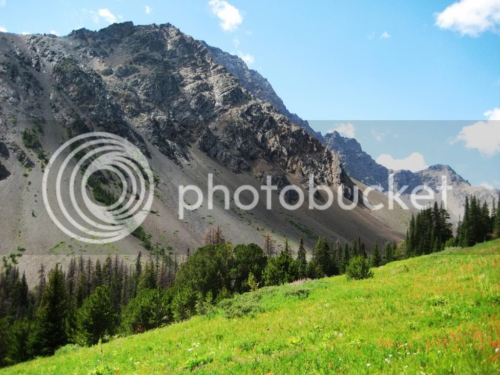
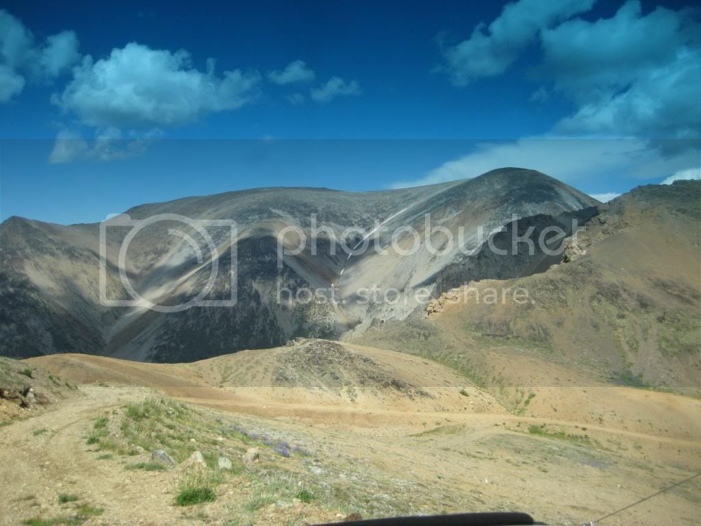
About Ochi: This area was home to a molybdenum mine about 1915. Of all the material I could find, nothing says this was an operating mine. However, at the top of the mountain (8400 ft) there is evidence in the form of road cuts, wooden poles and ladders that show something was going on up there. There are numerous mining claims seen from the trail and a nearby lake also accessed in the Ochi Basin lays claim to the name of molybdenum lake. This lake is only accessible by quad or zuks.
Getting There: We traveled the connector to Merrit, then took Highway 8 to Spences Bridge. We traveled south on Highway 1 to Lytton, and then took Highway 12 to Lillooet. (this was a four hour trip with a stop in Starbucks at Merritt and fuel in Lytton.
After getting to Lillooet we stocked up at Buy Low for some lunch. Note return trips have been posted at 5 hours from Lillooet. It was actually 7 hours for us and I'm glad we bought a little extra food.
We then headed south on Highway 99 out of town and turned left onto Texas Creek Road (not the FSR). This road is the second left south of the one lane bailey bridge you use to exit Lillooet.
About +- 15 to 20 minutes we found Texas Creek FSR on the right. This road cuts through a very narrow high cliffed canyon. There's a gate that apparently is not opened til August first and this may be to allow the grizzlies peace before humans show up. We aired down here and while I was draining air, Mike and Jason in their Tacomas showed up. I had met Mike at Cruiser Days two weeks before and he has a nice truck with ARB tent, on an open rack over the bed. This was Jason's first trip in his new suspension.
We lucked out as Mike had been here before and knew what to expect. He was an excellent guide letting us know what was ahead and we stopped a few times to talk about the trail. Mike had actually seen grizzlies up in the basin so we were hopeful.
We headed up the Molybdenite Main FSR which intersects Texas Creek FSR. This is when the climbing really started. There are some water bars but not many and about 400 meters of alder that overgrows the road but its not too heavy yet. In a year or so this will become a quad trail.
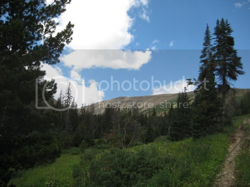
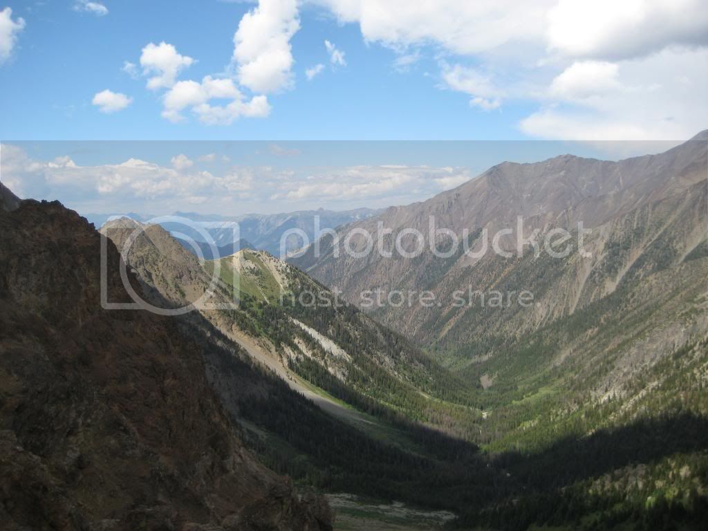
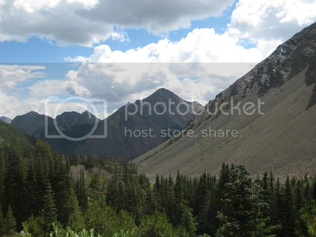
You then go through a section of heavy forest and come to another "T". If you stay straight this will take you to the lake but going right will lead you up Ochi Ridge. A short distance later and you break out into Alpine meadow and get the first glimpse of the ridge and the road that leads up there.

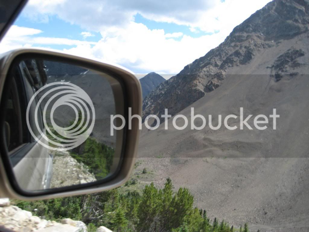
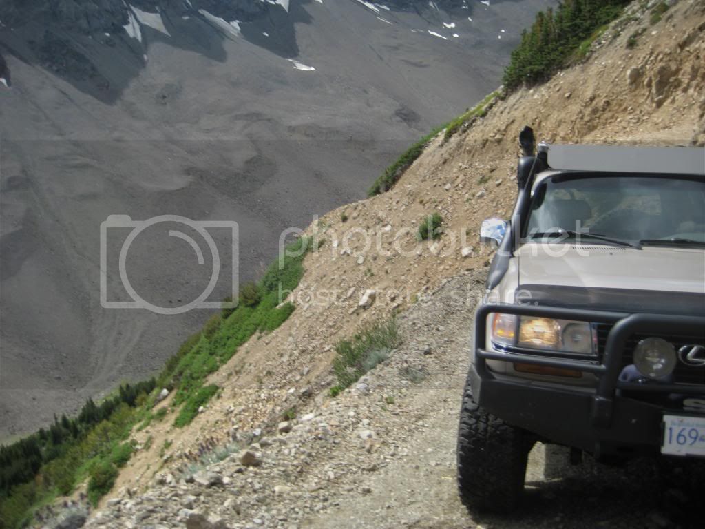
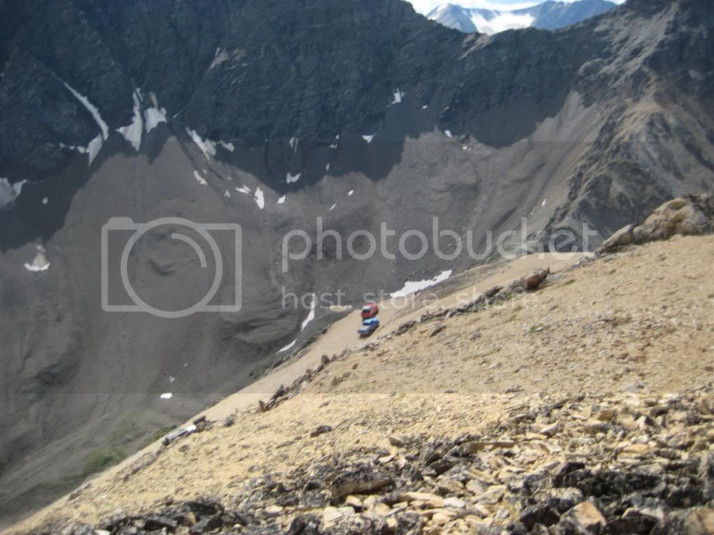
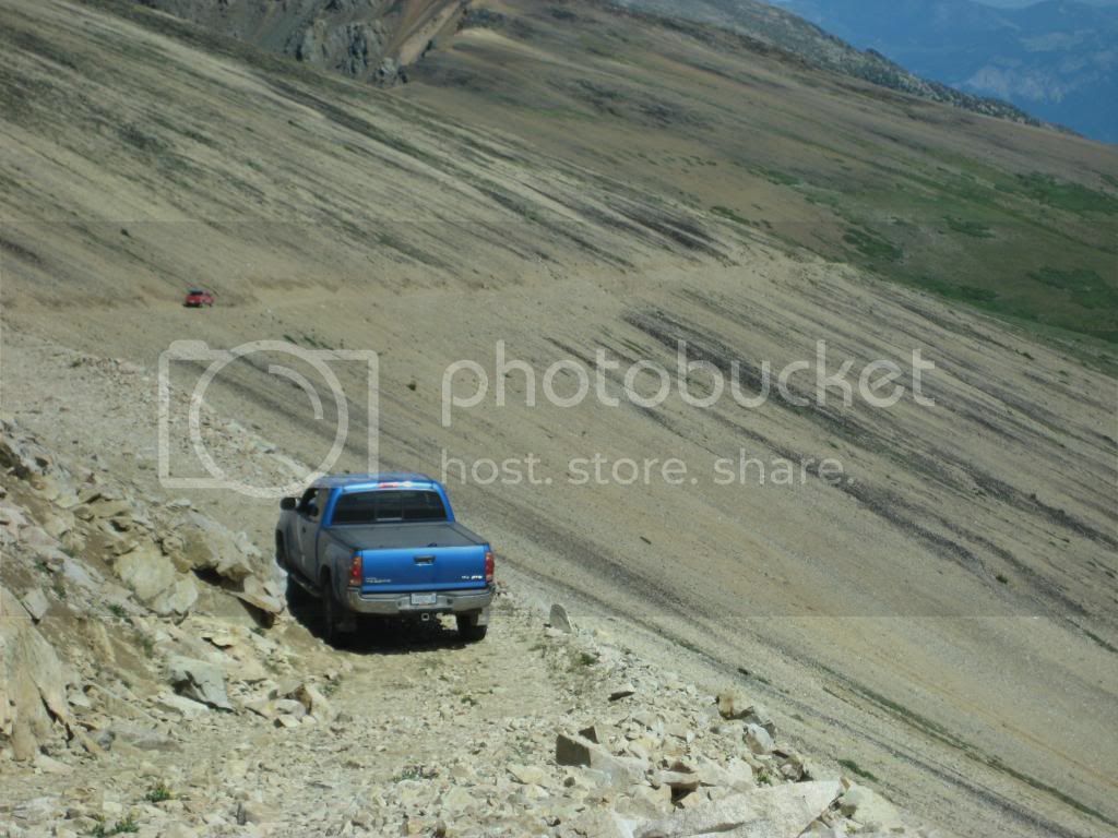
We stopped for a break and then started up. I was glad to be last as I had the benefit of watching the other trucks. There is no line to take, so there's no benefit here. The trail is the line! However, with my nose pointing in the air, and it being difficult to see more than sky at times, it was reassuring to see other trucks from time to time. It marked where the road was.
I'd be kidding to say that I enjoyed the view. I was intensely focused on the trail. In fact I think technical offroading is easier. Its challenging but this trip was about keeping your wits. There's a few off camber sections ( my wife walked one). There's no place to turn around until the first switch back, and at the saddle, so you would have to back down. Not something I would want to do.
An avalanche path cuts across the trail and at this point it is only axle width. The outer edge is eroded and your tire has to drop into it. On the return I swear my nose wagged towards the down slope side.
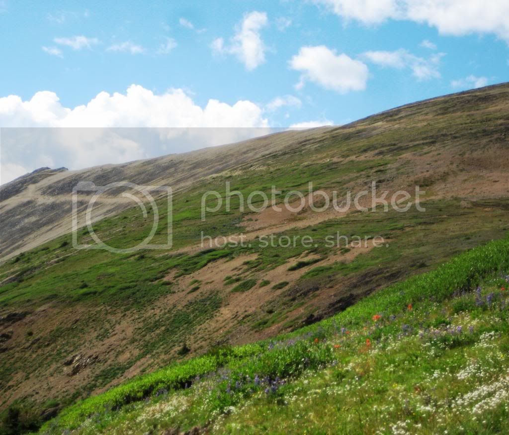
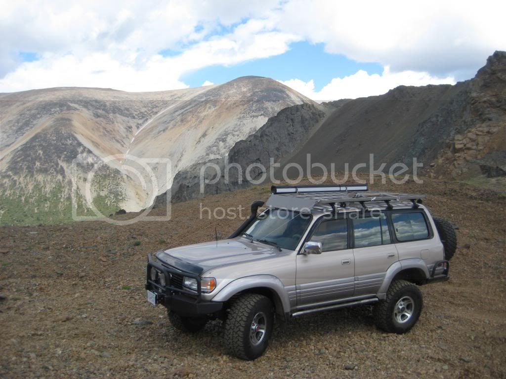
After the switch back the trail gets easier and you break out into a saddle with great views. This would be the ideal spot to turn around or stop and walk to the top. We chose to drive and Mike said the road just kind of disappears, and I thought it couldn't get any skinnier. It does!
We eventually got to the top and there was room for only one vehicle to turn around at a time. This is the first time I have been glad I had an automatic. The turn around landing is a three-four point turn and the only thing you can see is the mountain across the valley and your hood. I was glad the boys were spotting.
The rest is as is said, "Down hill."
When we got back to the Texas Creek Road we chose to carry on to the reaction Ferry at Lytton. We had hoped to do a circle route. About 20 minutes after we started I heard a grinding noise from my rear PS wheel and stopped to investigate. After removing the wheel, the noise went away so I must have picked up a rock that slipped out when I pulled the tire off. Thunder was looming, the distance to the ferry unknown, and we didn't know how late it ran so we chose to retrace our steps and return the way we came.
There was one side affect I didn't expect. I woke up the following morning with really sore forearms. I guess my grip on the wheel was pretty strong.
Great trip and will get stored in the memory box as a highlight!
On August long we decided to make a day trip out of this and everything we read about seemed to suggest that this was doable. Published drive times and trail conditions didn't lend well to that plan - we left at 7:00 am and got home at 11:30 pm.
However it was a fantastic day! Let me say this though, if your truck hasn't been serviced, your drive line is weak, e-brake doesn't hold, you have your small children with you and your passengers are afraid of heights or suffer from vertigo - This is not the trip for you. This is the first time I have chosen not to wear a seat belt off road. If something bad were to happen it would be a very long time to the stopping thud, I wanted to be able to bail before then.
About Ochi: This area was home to a molybdenum mine about 1915. Of all the material I could find, nothing says this was an operating mine. However, at the top of the mountain (8400 ft) there is evidence in the form of road cuts, wooden poles and ladders that show something was going on up there. There are numerous mining claims seen from the trail and a nearby lake also accessed in the Ochi Basin lays claim to the name of molybdenum lake. This lake is only accessible by quad or zuks.
Getting There: We traveled the connector to Merrit, then took Highway 8 to Spences Bridge. We traveled south on Highway 1 to Lytton, and then took Highway 12 to Lillooet. (this was a four hour trip with a stop in Starbucks at Merritt and fuel in Lytton.
After getting to Lillooet we stocked up at Buy Low for some lunch. Note return trips have been posted at 5 hours from Lillooet. It was actually 7 hours for us and I'm glad we bought a little extra food.
We then headed south on Highway 99 out of town and turned left onto Texas Creek Road (not the FSR). This road is the second left south of the one lane bailey bridge you use to exit Lillooet.
About +- 15 to 20 minutes we found Texas Creek FSR on the right. This road cuts through a very narrow high cliffed canyon. There's a gate that apparently is not opened til August first and this may be to allow the grizzlies peace before humans show up. We aired down here and while I was draining air, Mike and Jason in their Tacomas showed up. I had met Mike at Cruiser Days two weeks before and he has a nice truck with ARB tent, on an open rack over the bed. This was Jason's first trip in his new suspension.
We lucked out as Mike had been here before and knew what to expect. He was an excellent guide letting us know what was ahead and we stopped a few times to talk about the trail. Mike had actually seen grizzlies up in the basin so we were hopeful.
We headed up the Molybdenite Main FSR which intersects Texas Creek FSR. This is when the climbing really started. There are some water bars but not many and about 400 meters of alder that overgrows the road but its not too heavy yet. In a year or so this will become a quad trail.
You then go through a section of heavy forest and come to another "T". If you stay straight this will take you to the lake but going right will lead you up Ochi Ridge. A short distance later and you break out into Alpine meadow and get the first glimpse of the ridge and the road that leads up there.
We stopped for a break and then started up. I was glad to be last as I had the benefit of watching the other trucks. There is no line to take, so there's no benefit here. The trail is the line! However, with my nose pointing in the air, and it being difficult to see more than sky at times, it was reassuring to see other trucks from time to time. It marked where the road was.


I'd be kidding to say that I enjoyed the view. I was intensely focused on the trail. In fact I think technical offroading is easier. Its challenging but this trip was about keeping your wits. There's a few off camber sections ( my wife walked one). There's no place to turn around until the first switch back, and at the saddle, so you would have to back down. Not something I would want to do.
An avalanche path cuts across the trail and at this point it is only axle width. The outer edge is eroded and your tire has to drop into it. On the return I swear my nose wagged towards the down slope side.

After the switch back the trail gets easier and you break out into a saddle with great views. This would be the ideal spot to turn around or stop and walk to the top. We chose to drive and Mike said the road just kind of disappears, and I thought it couldn't get any skinnier. It does!


We eventually got to the top and there was room for only one vehicle to turn around at a time. This is the first time I have been glad I had an automatic. The turn around landing is a three-four point turn and the only thing you can see is the mountain across the valley and your hood. I was glad the boys were spotting.
The rest is as is said, "Down hill."


When we got back to the Texas Creek Road we chose to carry on to the reaction Ferry at Lytton. We had hoped to do a circle route. About 20 minutes after we started I heard a grinding noise from my rear PS wheel and stopped to investigate. After removing the wheel, the noise went away so I must have picked up a rock that slipped out when I pulled the tire off. Thunder was looming, the distance to the ferry unknown, and we didn't know how late it ran so we chose to retrace our steps and return the way we came.
There was one side affect I didn't expect. I woke up the following morning with really sore forearms. I guess my grip on the wheel was pretty strong.
Great trip and will get stored in the memory box as a highlight!
Last edited: